additional window
Fig. 211
Split screen
›
To switch on/offin the main menu Navigation, tap on the function surface
→
Split screen
.
›
To select content of the additional window
A
» Fig. 211 tap the function
surface
and select one of the following menus, depending on the context.
■
Audio
- Operation of
Radio
/
Media
playback
■
Compass
- Displays the current vehicle location in relation to the compass di-
rections
■
Most frequent routes
- Display the three most frequent routes (if guidance not
being carried out) » page 194
■
Manoeuvre
- Displays graphical driving recommendations (if route guidance is
enabled) » page 194
■
Position
- Displays the geographical coordinates of the current vehicle loca-
tion
■
Map
- Displays the preview map (applies to Infotainment Columbus)
» page 191
Google Earth
™
online map
Only valid for Infotainment Columbus.
Fig. 212
Google Earth™ map
In the Google Earth
™
map, the map is represented based on the images down-
loaded from the Internet.
›
To display, tap the function surface
F
» page 189, Options for map display,
The map and symbol display in the Google Earth
™
map is dependent on the
provider, American company Google, Inc.
To display the Google Earth
™
map, the following conditions are required.
The Infotainment Online online services are activated» page 11.
Internet connection » page 18.
The signal from the data service provider network for the data connection
is available.
Note
■
In the Google Earth
™
Display is possible no insertion of the symbols of the
POI categories.
■
When driving through a tunnel changes the 3D representation of the Google
Earth
™
Card automatically in the 2D display.
■
The speed of the Google Earth
™
display depends on the Internet connection
speed.
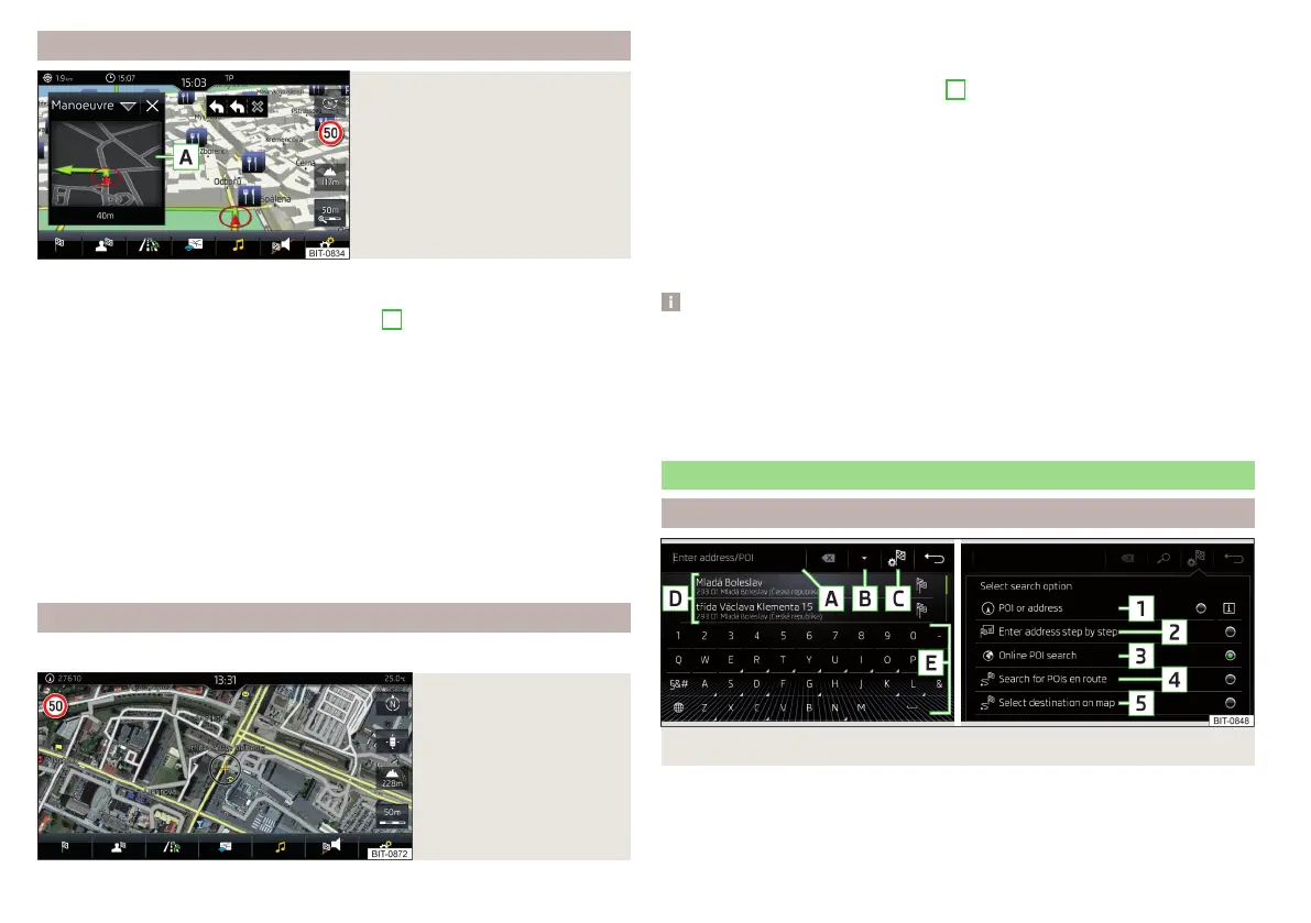
Search for destination and enter
Search POI destination /
Fig. 213 Destination search: Main menu/Search mode selection
182
Infotainment

 Loading...