AP-9
APPX. 2 LONGITUDE ERROR TABLE
(96 NM SCALE)
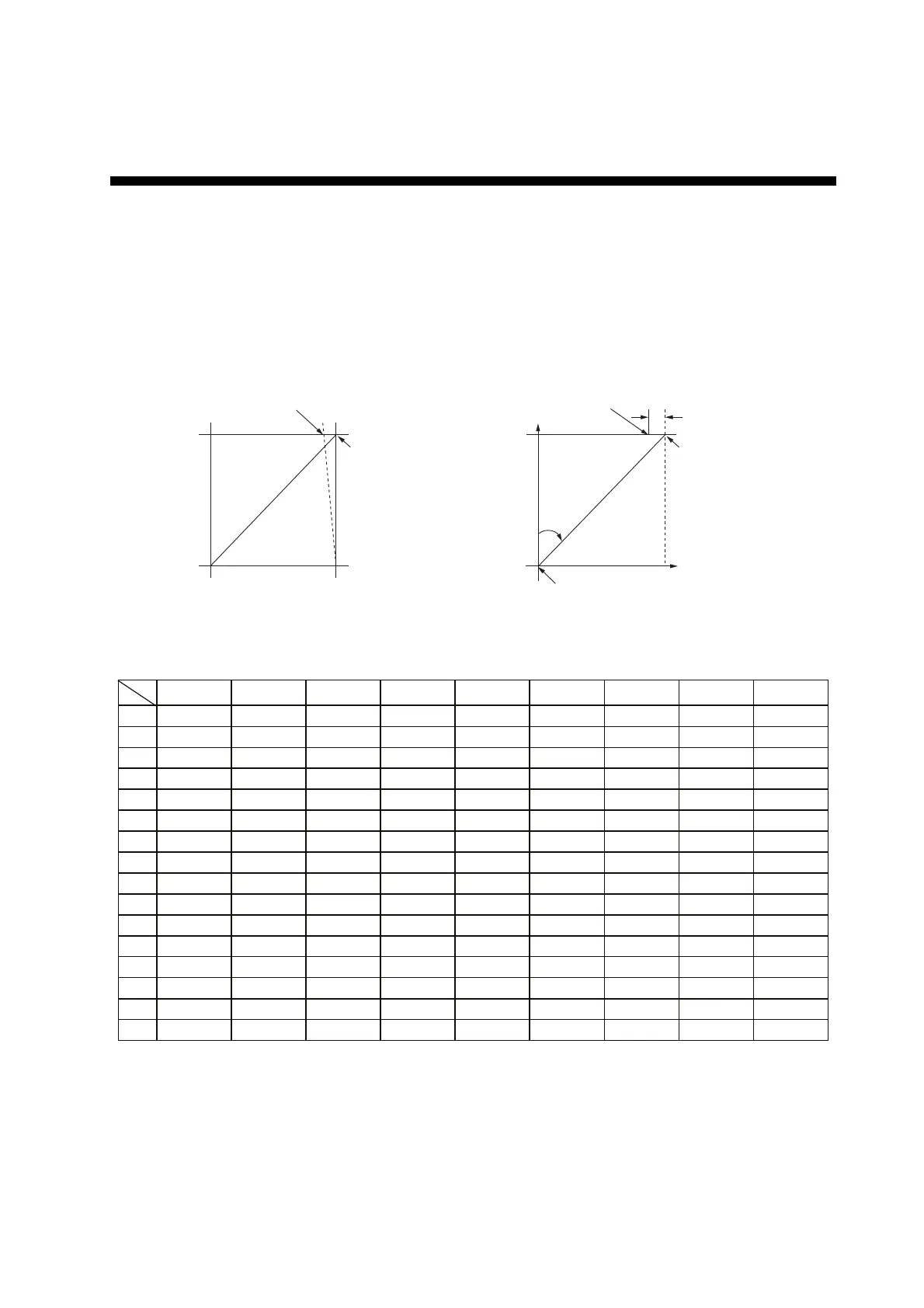
The longitude lines concentrate on the north pole and south pole, namely, 1 nm is equivalent to 1
minute at 0 degree latitude, 2 minutes at 60 degrees latitude, 3 minutes at 70 degrees latitude and
so on. For this reason, a longitude error occurs on the radar display.
For example, when own ship is at 60°N and 135°E, even if the cursor indication is 62°N and 139°E,
the real cursor position is deviated to the left (west) side. The table below shows the longitude er-
ror, represented from 0° to 90° at 96 nm from the radar center (own ship).
62°N °N
60°N
135°E
°E
96 nm
q
Real cursor position
Cursor position
indicated
139°E
LAT
Real cursor position
R: Error
Cursor position
indicated
OS position
0.2256 0.4444 0.6496 0.8350 0.9950 1.1248 1.2202 1.2786 1.2980
0.21980213 0.43290201 0.632803 0.8134132 0.96923215 1.09551918 1.1884382 1.24517456 1.26402037
0.21229339 0.41810678 0.61115946 0.78556318 0.93600295 1.05790007 1.14755221 1.20224625 1.22034042
0.20316898 0.40012949 0.58486463 0.75173456 0.89565021 1.0122297 1.09793265 1.15016811 1.16737294
0.19249832 0.37910698 0.55411863 0.71218478 0.84848102 0.95885565 1.03998717 1.08933651 1.10552105
0.18036264 0.35519924 0.51915545 0.66721485 0.79485438 0.89818413 0.97406698 1.02021439 1.03525547
0.16685429 0.32858822 0.48024119 0.61716701 0.73517843 0.83067689 0.90076355 0.94332783 0.95711098
0.15207608 0.29947644 0.437672 0.56242216 0.66990732 0.7568477 0.82060477 0.85926197 0.87168229
0.13614047 0.26808546 0.39177186 0.53339693 0.59953781 0.67725844 0.73420069 0.76865661 0.77961957
0.11916876 0.2346542 0.3428901 0.44054055 0.52460545 0.59251483 0.6422089 0.67220131 0.68162348
0.10129001 0.19943707 0.29139874 0.37433139 0.44568053 0.50326182 0.54532952 0.57063015 0.57843983
0.08264056 0.16270211 0.23768966 0.30527334 0.36336372 0.41017869 0.44429984 0.46471615 0.47085389
0.06336208 0.12472888 0.18217162 0.23389198 0.27828148 0.31397386 0.33988878 0.35526538 0.35968447
0.04360137 0.0858064 0.12526714 0.16073056 0.19108136 0.21537949 0.23289096 0.24311083 0.24577764
0.02350833 0.04623087 0.0674093 0.08634588 0.10242699 0.11514595 0.1241207 0.12910605 0.13000029
0.00323737 0.0063035 0.00903844 0.01130406 0.01299309 0.01403609 0.0144058 0.0141187 0.01323356
75°
70°
65°
60°
55°
50°
45°
40°
35°
30°
25°
20°
15°
10°
5°
0°
5
°
10
°
15
°
20
°
25
°
30
°
35
°
40
°
45
°
LAT
q
(nm)
 Loading...