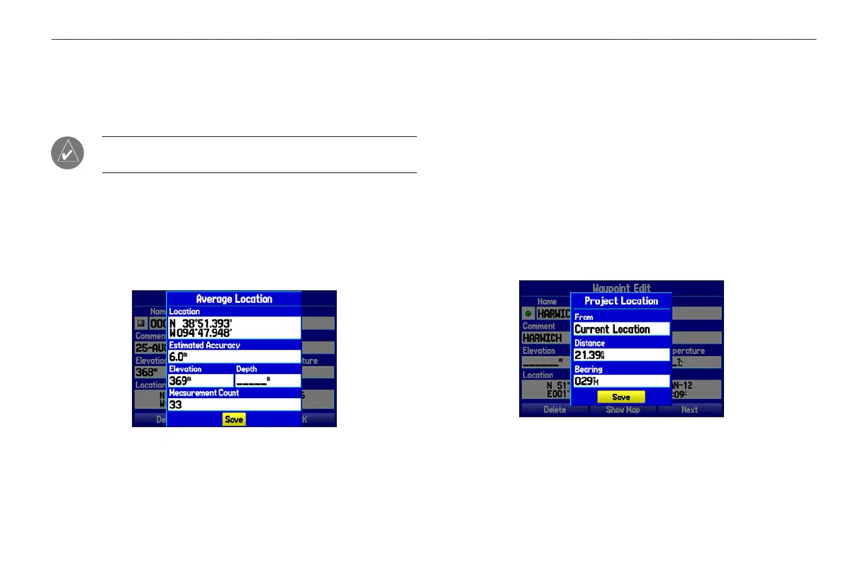
Averaging the Waypoint’s Location
Average Location makes the unit take several sample location
measurements for the waypoint and recalculate for a more accurate
location reading.
NOTE: You must have a GPS satellite fix before you can
average a waypoint’s location.
To calculate the average location:
1. Open the Waypoint Page, and press MENU.
2. Select Average Location, and press ENTER. The Average
Location window appears. The fields change as the unit
calculates the average location of the waypoint.
3. Press ENTER to save the location.
Projecting a Waypoint
You can create a new waypoint by projecting the distance and
bearing from a specific location to a new location.
To create a
new waypoint by projecting its location:
1. Create a waypoint. The new waypoint uses the next available
waypoint number and the receiver’s last known location as
the default location.
2. Highlight the Points tab on the Main Menu, and then select a
waypoint. Press ENTER.
3. Press MENU to open the New Waypoint Page options menu.
4. Highlight Project Location, and press ENTER.
Project Location Menu
32 GPSMAP 278 Owner’s Manual
MARINE MODE > CREATING AND USING WAYPOINTS
 Loading...