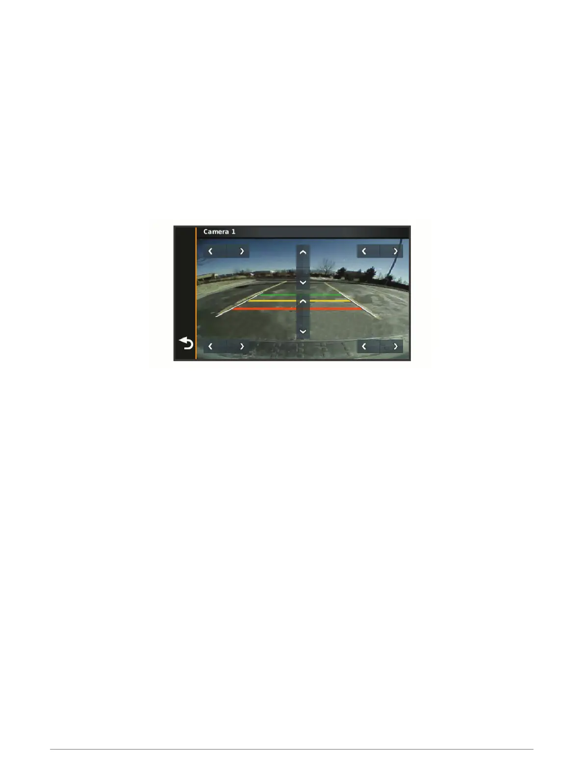
Aligning the Guidance Lines
For the best reference, the guidance lines should be aligned to reflect the outside edges of the vehicle. You
should align the guidance lines separately for each backup camera. When you change the camera angle, you
should immediately align the guidance lines again.
1 Position your vehicle with the driver's side closely aligned to a kerb, driveway or parking stall lines.
TIP: it can be helpful to position the vehicle in the centre of a parking stall and then pull forward into the next
stall. This allows you to use the parking stall lines at the rear of the vehicle as reference points for
alignment.
2 From the paired Garmin navigation device, select Settings > Wireless Cameras.
3 Select the paired camera name and select Guidance Lines > Adjust Guidance Lines.
4 Use the arrows in the corners of the screen to move the ends of the white, driver's-side guidance line.
The guidance line should appear directly on top of the kerb, driveway or parking stall line.
5 Use the arrows in the centre of the screen to move the coloured distance guidance lines up or down.
The red guidance line should be aligned with the rearmost part of your vehicle. This could be the rear
bumper, a trailer hitch or another object protruding from the rear of the vehicle.
6 Reposition the vehicle with the passenger side closely aligned to a kerb, driveway or parking stall lines and
use the arrows to align the white, passenger-side guidance line.
The guidance lines should be symmetrical.
Appendix 59
 Loading...