Yara N-Sensor V3.10 Operation Manual
Preview: A map of the recorded data is displayed. This option becomes available as
soon as data have been recorded to the selected task. You can choose between
previews of the N-Sensor recommendation map, the as-applied map and the bio-
mass map. A crosshair marks the current vehicle position on the maps. This can
be helpful for field scouting or for finding the point in the field where the application
has been paused. Note that creating the preview may take some time depending
on processing power, map size and grid size.
4.1 Batch processing
The Batch processing menu allows to transmit or to delete multiple files at a single
keypress. Provided that the terminal computer has access to the Internet (usually
through a GSM, GPRS, UMTS or WLAN connection), data files can be easily transmit-
ted to the central SensorOffice server to automatically produce documentation maps
out of the recorded data within minutes. The server will then immediately send an e-
mail with the raw data and the processed maps to a user-selectable e-mail address.
Since all relevant files are sent through the Internet, there is no need to move a data
card or a USB stick from the terminal to an office PC.
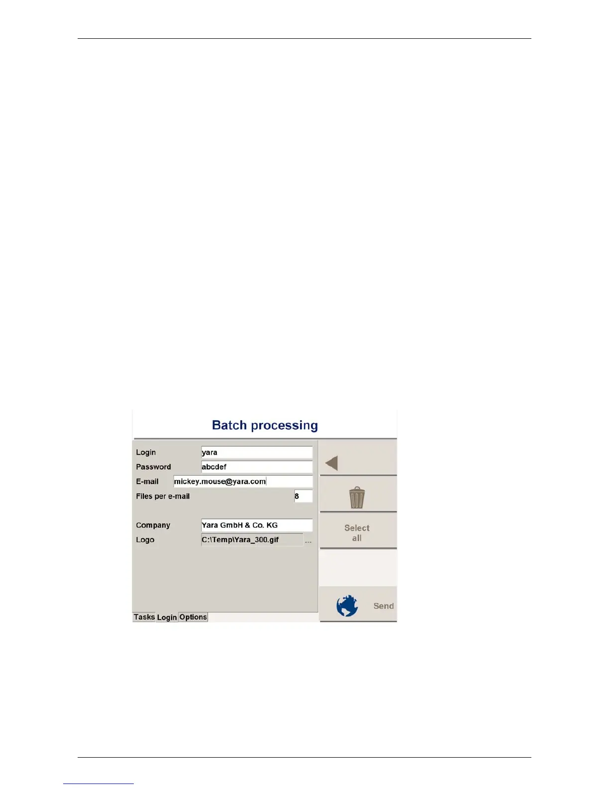
The Batch processing menu contains three individual pages: Tasks, Login and Options.
For normal operation only the Tasks page is required. The settings on the Login page
and the Options page are usually made once only and then left untouched.
4.1.1 Setting up
To initially set up the Internet data transfer, switch to the Login page:
Enter the login and password from the SensorOffice registration. Enter the return ad-
dress for the map products and the maximum number of files per e-mail. Optionally, a
company name and a company logo may be added. Both will be displayed on the print-
out later.
Switch to the Options page and enter the batch options:
Last revised: 28.01.2009 14:39 Page 25 of 64
 Loading...