2-1
2. OPERATIONAL OVERVIEW
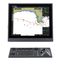
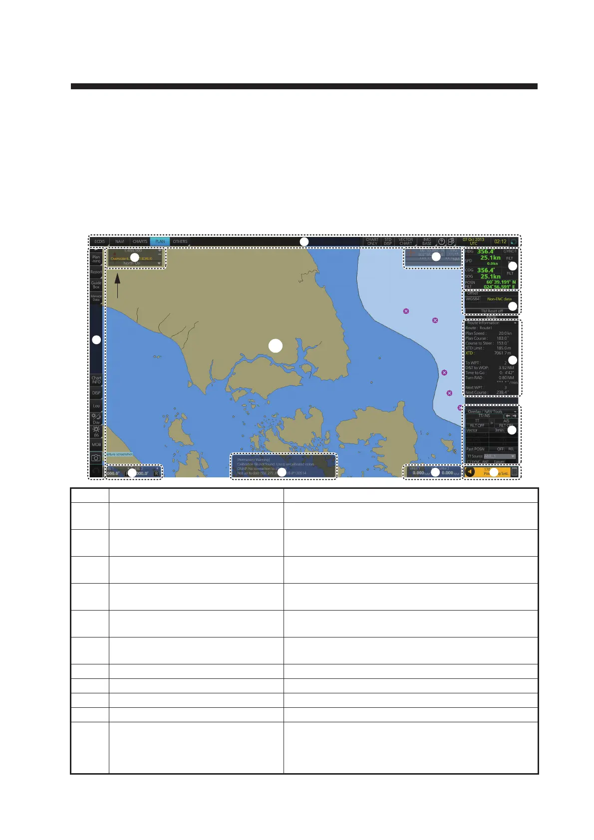
2.1 ECDIS Display
The ECDIS (Electronic Chart Display and Information Systems) screen is divided into
several areas, as illustrated below. The ECDIS operational area has no limitations.
That is, high latitudes (85° and higher) are correctly displayed always. The ECDIS
uses “cylindrical equidistant” projection for areas of high latitude and small chart
scales. All other conditions use the “orthographic” presentation.
No. Name Description
1 Status bar Provides for selection of operating mode, chart for-
mat, etc.
2 Cursor position box Shows the latitude/longitude position of the cursor
and TTG to the cursor.
3 Sensor information box Displays ship's speed, course and position and se-
lects sensors.
4 Own ship functions box Applies offset to the chart; changes geodetic data
system, and provides true motion reset.
5 Route information box Shows route and waypoint data, when a route is se-
lected for navigation.
6 Overlay/NAV Tools box Provides for setup of the radar overlay and naviga-
tion-related functions.
7 Alert box Shows operational and system alert messages.
8 VRM boxes Measure the range to an object.
9 Permanent warning box Displays chart-related warning messages.
10 EBL boxes Measure the bearing to an object.
11 InstantAccess bar™ Provides quick access to functions such as brilliance
adjustment, display palette and the menu. The con-
tents of the upper part of the bar change according to
the ECDIS mode selected.
EE
1
2
7
8
9
10
11
12
13
5
Turn Rate
6
 Loading...