9-2
different speed to calculate time requirements.
The GPS 100 will display the distance and bearing between the two
geographical points. In addition, the time requirement will be displayed
based on speed. Use the cyclic field to select estimated time enroute (ETE)
or estimated time of arrival (ETA).
To perform trip planning for a programmed route...
• Use the CLR key to select the desired route as illustrated below. (The
waypoint/route selection field will cycle through all programmed
routes containing 2 or more waypoints, i.e., RT0 to RT9.)
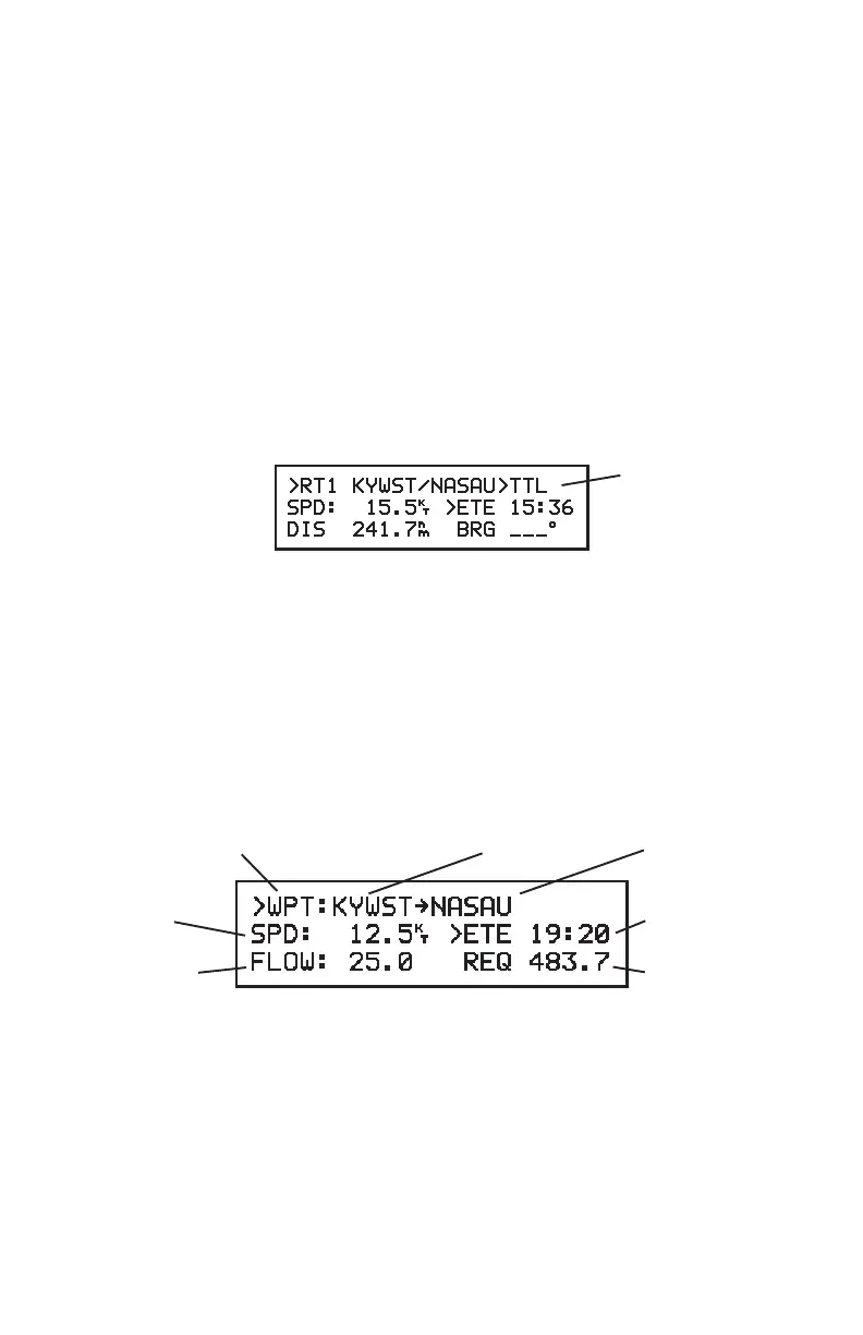
Total/Leg
Selection
• The first and last waypoints, total distance, and ETA/ETE information
will be displayed for the entire route, as indicated by “TTL”.
• To display the distance, bearing, and ETA/ETE information for each
individual leg, use the CLR key to change from “TTL” to the desired
leg. (The leg field will cycle through every programmed leg, i.e., LG1
to LG8, and the route total, TTL.)
9.2 FUEL PLANNING
Waypoint/Route Selection From Waypoint To Waypoint
Speed Time
Fuel Flow Fuel Required
FUEL PLANNING PAGE
The Fuel Planning Page allows you to calculate fuel requirements for any
route you have programmed or between any two waypoints.
To calculate the fuel requirements between two waypoints...
 Loading...