SonTek, a Xylem brand
14 RiverSurveyor S5/M9 System Manual (February 2013)
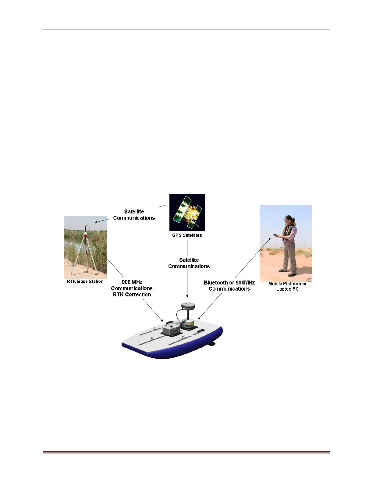
3.5. Configuration D – RTK GPS
3.5.1. Description
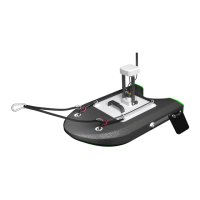
Figure 14 shows the RiverSurveyor system with RTK GPS (with precision to ±3 cm) and wire-
less communications using a small, unmanned boat such as the SonTek Hydroboard. GPS po-
sition data is received at 10-hz by both the RTK Base Station and ADP (on the rover). The RTK
GPS correction is transmitted at 1-hz from the RTK Base Station to the unmanned boat via
Spread Spectrum communications. The SonTek Hydroboard is used below for conceptual pur-
poses.
Note: A sub-meter correction will be maintained up to 45-minutes if communications with the
RTK Base Station is lost and after an RTK correction has been established. If the RTK Base
Station will not be used for the measurement the user must switch the GPS application to
“DIFF” for differential measurements.
Figure 14. Wireless Communications with RTK GPS
 Loading...