5. VIDEO PLOTTER OPERATION
5-16
How to erase tracks with the cursor (For B/W-types only)
1. Open the menu.
2. Select [2 MARKS].
For B/W-types with Radar Plotter functionality, select [2 MARKS•CHART].
3. Select [8 DELETE DATA].
4. Select [7 OS TRACK-AREA] or [8 TGT TRACK-AREA].
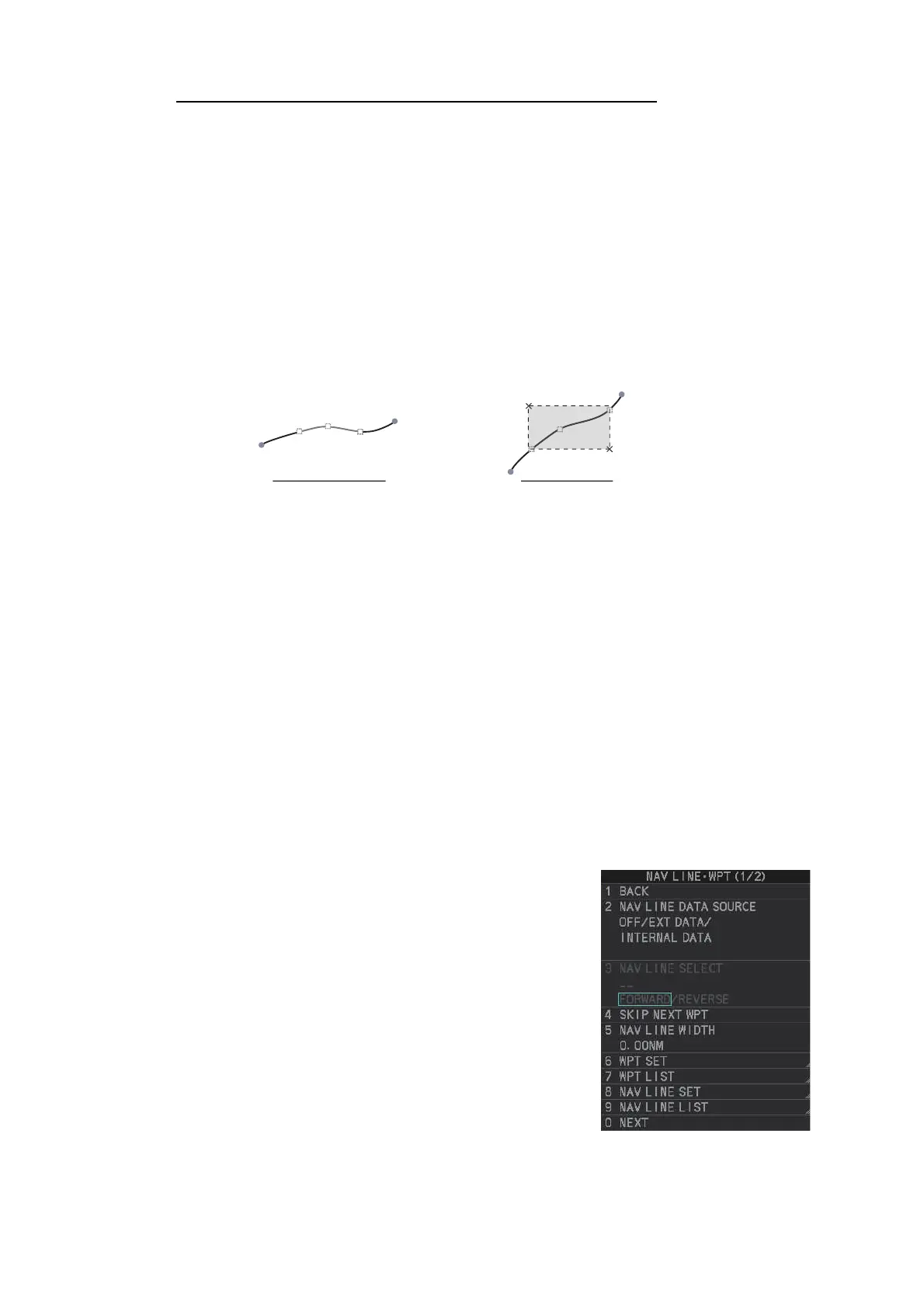
5. Select [2POINTS] or [AREA] as appropriate, then left-click. The cursor jumps into
the operational display area.
[2POINTS]: Delete track between two points. All points between start point to end
point change from circle-shaped to square-shaped icons.
[AREA]: Delete all track within an area. Points within the selected area change
from circle-shaped to square-shaped icons.
6. Place the cursor on the first point (A), then left-click.
7. Place the cursor on the second point (B), then left-click. If [AREA] was selected at
step 5, the two points form a square.
8. Close the menu.
5.9 How to Use Waypoints
A particular location is known as a “waypoint”, whether it be a starting point, a desti-
nation point or an intermediate point on a voyage. This radar system can store 200
waypoints. Waypoints 1 to 198 are user set waypoints, waypoint 199 is reserved for
external input, waypoint 200 is reserved for MOB (Man Over Board). Waypoints can
be entered with the cursor, or from the menu (manual input of latitude and longitude).
Waypoints 1 to 198 can be edited from the menu.
5.9.1 How to set the data source for waypoints
1. Open the menu.
2. Select [8 NAVLINE•WPT].
3. Select [2 NAV LINE DATA SOURCE].
4. Select the appropriate data source, referring to the
list below.
5. Close the menu.
• [OFF]: Waypoints and nav lines (such as tracks)
are not shown.
• [EXT DATA]: Use navigational data from an ex-
ternal EPFS device for waypoints and nav lines.
• [INTERNAL DATA]: Use waypoints and nav lines
saved internally.
• [WPT MARK] (shown only for A/B/W-type ra-
dars): Shows the waypoint marks, however re-
ceived routes are not shown.
[2POINTS] method [AREA] method
A
A
B
B