GPS and Other Satellite Systems
Using GPS and another satellite system together offers increased performance in challenging environments
and faster position acquisition than using GPS only. However, using multiple systems can reduce battery life
more quickly than using GPS only.
Your device can use these Global Navigation Satellite Systems (GNSS).
GPS: A satellite constellation built by the United States.
GLONASS: A satellite constellation built by Russia.
Satellite Page
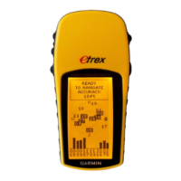
The satellite page shows your current location, GPS accuracy, satellite locations, and signal strength.
Changing the Satellite View
1 From the main menu, select Satellite.
2 Select menu.
3 Select an option:
• To orient the satellite view with your current track toward the top of the screen, select Track Up.
• To show a unique color for each satellite and its signal strength bar, select Multicolor.
NOTE: This feature is not available for all device models.
Turning Off GPS
You can turn off GPS on your device to stop tracking your location.
1 From the main menu, select Satellite.
2 Select menu > Use with GPS Off.
Simulating a Location
You can use the device with GPS off to perform maintenance on waypoints and routes, or to conserve battery
life. You can set the location manually to view your current location on the map.
1 From the main menu, select Satellite.
2 Select menu > Use with GPS Off.
3 Select a location.
4 Select Use.
GPS Satellite Settings
Select Satellite > menu.
NOTE: Some settings are only available when Use with GPS Off is enabled.
Toggle GLONASS: Allows you to enable or disable the GLONASS satellite system (GPS and Other Satellite
Systems, page 13).
Use with GPS On or Use Satellite System: Allows you to turn the GPS on.
Use with GPS Off or Use Demo Mode: Allows you to use the device with the GPS turned off.
Track Up: Indicates whether satellites are shown with rings oriented with north toward the top of the screen or
oriented with your current track toward the top of the screen.
Single Color: Allows you to select whether the satellite page is displayed in multicolor or single color.
Set Location On Map: Allows you to mark your current location on the map. You can use this location to create
routes or search for saved locations.
AutoLocate Position: Calculates your GPS position using the Garmin AutoLocate
®
feature.
GPS and Other Satellite Systems 13
 Loading...
