EasyManuals Logo

Garmin eTrex 20 User Manual

Garmin eTrex 20
168 pages
To Next Page IconTo Next Page
To Previous Page IconTo Previous Page
Page #111 background imageLoading...
Page #111 background image
petunjuk teknis penggunaan untuk model 10, 20, 30
109
ID
Untuk Memulai
Untuk Memulai
PERINGATAN
Lihat panduan Informasi Penting
Tentang Keselamatan dan Produk
dalam kemasan produk untuk
mengetahui peringatan dan
informasi penting lainnya terkait
produk.
Bila menggunakan perangkat
untuk pertama kalinya, Anda harus
menyelesaikan langkah berikut
untuk mengkongurasi perangkat
dan memahami berbagai tur
dasarnya.
1. Memasang baterai (halaman
111).
2. Mengaktifkan perangkat
(halaman 113).
3. Mencari sinyal satelit (halaman
113).
4. Daftarkan perangkat (halaman
113).
5. Membuat waypoint (halaman
114).
6. Membuat rute (halaman 117).
7. Merekam jejak (halaman 119).
8. Navigasi ke tujuan (halaman
122).
9. Kalibrasi kompas (halaman
124).
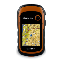
Table of Contents

Other manuals for Garmin eTrex 20

Questions and Answers:

Question and Answer IconNeed help?

Do you have a question about the Garmin eTrex 20 and is the answer not in the manual?

Garmin eTrex 20 Specifications

General IconGeneral
Outdoor (hiking, trekking)Yes
Marine (chartplotters, sounders)No
Routes quantity200
Number of waypoints2000
Form factorHandheld
Display diagonal2.2 \
Display resolution176 x 220 pixels
Display number of colors65536 colors
Display size (HxV) (imperial)1.7 x 1.4 \
Internal memory1740 MB
USB 2.0 ports quantity1
Battery typeAA
Battery life (max)25 h
Battery technologyNickel-Metal Hydride (NiMH)
Number of batteries supported2
Weight and Dimensions IconWeight and Dimensions
Depth33 mm
Width54 mm
Height103 mm
Weight141.7 g

Related product manuals