EasyManuals Logo

Garmin eTrex 20 User Manual

Garmin eTrex 20
168 pages
To Next Page IconTo Next Page
To Previous Page IconTo Previous Page
Page #8 background imageLoading...
Page #8 background image
6 owners manual for use with models 10, 20, 30
Getting Started
EN
Turning the Device On or
Off
Hold .
Satellite Signals
After the device is turned on, it
begins acquiring satellite signals.
The device may need a clear view
of the sky to acquire satellite
signals. When the GPS bars on the
backlight page
(page 38) are solid green, your
device has acquired satellite
signals. The time and date are set
automatically based on the GPS
position.
For more information about GPS,
go to http://www.garmin.com/
aboutGPS.
Registering Your Device
Go to http://my.garmin.com.
Keep the original sales receipt,
or a photocopy, in a safe place.
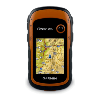
Table of Contents

Other manuals for Garmin eTrex 20

Questions and Answers:

Question and Answer IconNeed help?

Do you have a question about the Garmin eTrex 20 and is the answer not in the manual?

Garmin eTrex 20 Specifications

General IconGeneral
Outdoor (hiking, trekking)Yes
Marine (chartplotters, sounders)No
Routes quantity200
Number of waypoints2000
Form factorHandheld
Display diagonal2.2 \
Display resolution176 x 220 pixels
Display number of colors65536 colors
Display size (HxV) (imperial)1.7 x 1.4 \
Internal memory1740 MB
USB 2.0 ports quantity1
Battery typeAA
Battery life (max)25 h
Battery technologyNickel-Metal Hydride (NiMH)
Number of batteries supported2
Weight and Dimensions IconWeight and Dimensions
Depth33 mm
Width54 mm
Height103 mm
Weight141.7 g

Related product manuals