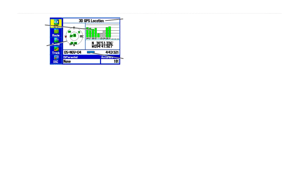
GPS Page
Receiver
Status
Field
Sky view
Signal
Strength
Bars
Power
Source
Indicator
The progress of satellite acquisition is shown in three stages:
• No signal strength bars—the receiver is looking for the
satellites indicated.
• White signal strength bars—the receiver has found the
satellite and is collecting data.
• Green signal strength bars—the receiver has collected the
necessary data from this satellite.
As soon as the GPSMAP 276C has collected the necessary data from
the best satellites in view to calculate a fix, the status field indicates
the status of the receiver. The unit then updates the position, date
and time.
Receiver Status
The Receiver Status field displays one of the following conditions:
• Searching the Sky—the receiver is looking for satellites.
• AutoLocate—the receiver is looking for any satellite whose
almanac has been collected, which can take up to 5 minutes.
• Acquiring Satellites—the receiver is looking for and
collecting data from satellites visible at its last known or
initialized position, but has not acquired a fix.
• 2D GPS Location: At least three satellites have been acquired
and a two-dimensional position fix has been calculated.
“2D Differential” appears when you are receiving DGPS
corrections in 2D mode and a “D” appears on the strength bar
of satellites being corrected.
• 3D GPS Location: At least four satellites have been
acquired and a three-dimensional fix has been calculated.
“3D Differential” appears when you are receiving DGPS
corrections in 3D mode and a “D” appears on the strength bar
of satellites being corrected.
• Lost Satellite Reception—the receiver is no longer tracking
enough satellites for a 2D or 3D fix.
• Receiver Not Usable—the receiver is unusable, possibly due
to interference or abnormal satellite conditions. Turn the unit
off and back on to reset.
• Simulating GPS—the receiver is in simulator mode.
• GPS Off—the GPS receiver is turned off.
GPSMAP 276C Owner’s Manual 5
GETTING STARTED > GETTING SATELLITE SIGNALS
 Loading...