29GTN 750: OTHER FEATURES AND CUSTOMIZATION
waypoint.
d. In the Waypoint Identier window, use the keypad or TOUCH Find to enter the name of a new way-
point and TOUCH Enter.
4. To create a new user waypoint, TOUCH Create Waypoint. For more information about creating user
waypoints, see “Using User Waypoints” earlier in this manual.
Use optional services
You can connect a GTN to many optional services, such as a telephone and satellite music channels. e
choices available on the Services page depend on the equipment and services that are connected to your GTN.
For more information about these features, see “14 Services/
Music” in the GTN 725/750 Pilot’s Guide.
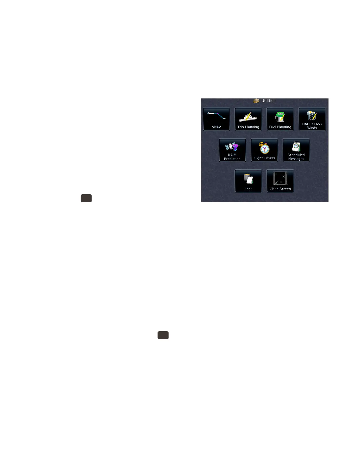
Using the GTN Utilities
e GTN includes a variety of utilities to help you plan trips,
estimate fuel burn, perform E6B calculations, check RAIM,
set up ight timers and messages, and record electronic logs
onto SD cards. You can also use the Clean Screen utility to
temporarily turn o the touch screen so that you can clean it.
View the Utilities page
1. PRESS the
HOME
button in the upper right corner of
the bezel.
2. On the Home page, TOUCH Utilities.
VNAV and VCALC Options
If your GTN has system soware 6.5 or later, you can view information about the current VNAV Prole and
constraints. See “Using Vertical Navigation (VNAV) and Along-Track Osets” earlier in this manual.
If your GTN is using system soware prior to 6.5, or if you chose to retain the legacy VCALC (vertical
calculator), VCALC appears on the Utilities page.
When ying an active ight plan or proceeding direct-to a waypoint, VCALC computes the required ver-
tical speed and displays the time when you should start a descent to reach a specied altitude at or near a
waypoint location. VCALC is not available when groundspeed is less than 35 knots or aer the FAF on an
approach. When VCALC is active, the GTN displays messages on the navigation pages to alert you to begin a
descent.
Use VCALC instead of VNAV
1. To display the Utilities page, PRESS the
HOME
button in the upper-right corner of the bezel.
2. On the Home page, TOUCH Utilities.
3. On the Utilities page, TOUCH VCALC.
4. In the Utilities–VCALC window, TOUCH Target ALT to specify an altitude, such as the trac pattern
altitude at the destination airport.
5. To specify an MSL or AGL (above WPT) altitude, TOUCH Altitude Type.
6. To set a preferred vertical speed, TOUCH VS Prole.
7. To specify an oset in nautical miles prior to or aer the target waypoint, TOUCH Oset.
8. To change the waypoint, TOUCH Target Waypoint.
9. To return to the default settings for VCALC, TOUCH Restore Defaults.
10. To enable or cancel VCALC messages, TOUCH Display Messages.
 Loading...