EasyManua.ls Logo

Garmin Astro 320 User Manual

Garmin Astro 320
80 pages
To Next Page IconTo Next Page
To Previous Page IconTo Previous Page
Page #21 background imageLoading...
Page #21 background image
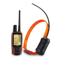
Astro 320 and DC40 Owner’s Manual 21
Waypoints, Routes, and Tracks



Waypoints are locations you record and
store in the device. After you mark a
location with your Astro, it is saved as
a waypoint.

1. From the main menu, select Start
New Hunt.
2. Follow the on-screen instructions.
After the hunt, you can navigate back
to your vehicle.

1. Press MARK.
2. Select New or choose a default
location name such as Truck or
Camp.
3. Select Done.

You can mark a covey location and
enter the estimated number of birds
ushed and the number of birds taken.
1. Press MARK.
2. Select Covey.
3. Enter the number of birds ushed.
4. Enter the number of birds taken.
5. Select Done.


1. Press MAP.
2. Move the map pointer to a location.
3. Press ENTER > MENU.
4. Select Save as Waypoint.

1. From the main menu, select Find >
Waypoints.
2. Select a waypoint.
3. Select Go.

Table of Contents

Other manuals for Garmin Astro 320

Questions and Answers:

Garmin Astro 320 Specifications

General IconGeneral
PurposePET
Product colorBlack, Blue, Red
Electronic compass-
Pre-installed mapsČeské republiky
Built-in displayYes
Battery life (max)- h
Cables includedAC, CI, USB
Weight and Dimensions IconWeight and Dimensions
Weight- g

Summary

Introduction to Garmin Astro 320

Getting Started with Astro 320

Initial setup steps for the Astro and DC 40 devices.

Installing Astro Batteries

Instructions for inserting AA batteries into the Astro handheld device.

Charging the DC 40 Collar

Procedure for charging the DC 40 collar unit's battery.

Turning On Astro and DC 40

Steps to power on both the Astro handheld and the DC 40 collar.

Acquiring Satellite Signals

How to ensure both devices get GPS satellite signals for tracking.

Attaching DC 40 to Dog

Guide on securely fastening the DC 40 collar to a dog's neck.

Astro Device Component Overview

Identifies and describes the physical components of the Astro handheld unit.

DC 40 and Keypad Component Overview

Details the DC 40 collar components and Astro keypad functions.

Adjusting Device Backlight

How to change screen brightness and timeout settings on the device.

Manual Conventions Explained

Explains common symbols and actions used throughout the manual.

Status Information Display

Interpreting icons for satellite strength, signal detection, and battery power.

On-Screen Messages Guide

Understanding device messages and temporary condition indicators.

Using the On-Screen Keyboard

Navigating and entering text using the device's virtual keyboard.

Tracking Your Dog with Garmin Astro

DC 40 Communication

Establishing and maintaining communication link between Astro and DC 40.

Navigating to Your Dog's Location

Using the Astro to find the location of your dog.

Viewing Dog Status on Tracker Page

Accessing the Dog Tracker page to see dog's direction and distance.

Dog Tracker Page Details

Explanation of the dog pointer, name, status icon, and distance displayed.

Understanding Dog Status Icons

Visual representations of a dog's current activity like sitting or running.

Editing Dog Information

Modifying a dog's name and type for accurate tracking.

Changing Dog Type Settings

Assigning specific dog types to display appropriate status symbols.

Tracking Dog Position on Map

Visualizing dog's location and movement history on the map interface.

Adding New Dogs to Track

Linking additional DC 40 collars to the Astro for multi-dog tracking.

Dog Signal Troubleshooting

Resolving issues related to conflicting dog ID signals or lost signals.

Assigning Dog ID Manually

Procedures for manually assigning unique IDs to dog units.

Removing Dogs from List

Steps to remove a dog from the Astro's tracking list.

Collar Lock Feature Security

PIN protection for dog's ID signal to prevent unauthorized tracking.

Astro and DC 40 Operational Tips

Practical advice for optimizing the use of Astro and DC 40 devices.

Resetting Dog Statistics

Clearing recorded hunting or tracking data for dogs.

Line-of-Sight Radio Communication

Understanding how radio signal quality is affected by obstructions.

Waypoints, Routes, and Tracks Management

Waypoints Management Guide

Recording, saving, and managing location points on the device.

Marking a Covey Location

Recording covey locations with bird flush and take data.

Marking Waypoints Using Map

Creating waypoints by selecting a location directly on the map.

Navigating to a Saved Waypoint

Guiding the user to a previously saved waypoint.

Editing Waypoint Information

Modifying existing waypoint attributes like name or location.

Finding Waypoints by Name

Searching for waypoints using a text-based spell search.

Finding Waypoints Near a Location

Locating waypoints that are geographically close to another waypoint.

Moving Waypoints on the Map

Relocating a waypoint's position by moving it on the map display.

Deleting Waypoints from Device

Removing waypoints from the device's memory.

Repositioning Waypoints

Updating a waypoint's location to the current device position.

Averaging Location for Waypoint Accuracy

Refining waypoint accuracy by taking multiple location readings.

Projecting a New Waypoint

Creating a new location by projecting distance and bearing from a known point.

Routes Management

Creating, navigating, and editing sequences of points for travel.

Creating a New Route

Step-by-step process for building a route with multiple points.

Reversing a Route Direction

Changing the direction of an existing route.

Deleting All Saved Routes

Removing all saved routes from the device.

Tracks Overview and Usage

Information about recording and analyzing paths and dog movements.

Recording Track Logs

Setting up and starting the device to record movement paths.

Viewing Tracks on the Map

Displaying recorded tracks visually on the device's map.

Viewing Track Elevation Plot

Analyzing the elevation changes along a recorded track.

Digital Elevation Models Maps

Using DEM maps for track elevation profiles.

Saving Track Logs (Entire/Part)

Storing entire or partial track logs for later use.

Marking Location on Saved Track

Adding waypoints to specific points on an existing track.

Starting a TracBack Navigation

Navigating back to the start of a recorded track.

Archiving Track Logs for Memory

Managing track logs to save memory space by archiving them.

Setting Automatic Track Archiving

Configuring the device to archive tracks automatically.

Clearing the Current Track Log

Removing the currently active track log from the device.

Deleting a Track Log

Permanently removing a saved track log.

Sharing Data Wirelessly

Transferring waypoints, routes, tracks, and geocaches between devices.

Sharing Dog Information Wirelessly

Exchanging dog tracking data between compatible Garmin devices.

Receiving Dog Information Wirelessly

Accepting dog tracking data from another Astro user.

Navigation Features and Map Usage

Map Display and Navigation Features

Understanding the map interface, position icon, and track logs.

Scaling the Map Display

Adjusting the map zoom level using the IN and OUT buttons.

Changing Map Orientation

Setting map view to North Up, Track Up, or Automotive Mode.

Measuring Distance on Map

Calculating distances between two points directly on the map.

Customizing Map Data Fields

Displaying up to four data fields for navigation information on the map.

Using the Find Menu

Searching for waypoints, cities, coordinates, and other points of interest.

Navigating to a Destination

Guiding the user towards a selected destination using the map or compass.

Stopping Active Navigation

Terminating an active navigation route.

Finding Recently Found Locations

Accessing a list of recently searched or navigated-to locations.

Finding Points of Interest

Locating specific types of places like cities, routes, tracks, or photos.

Finding Location Using Coordinates

Navigating to a location specified by its geographical coordinates.

Detailed Maps Functionality

Using optional maps for searching addresses and points of interest.

Finding an Address

Searching for and navigating to specific street addresses.

Finding a Point of Interest

Locating restaurants, hotels, and other POIs by category or name.

Navigation Tools and Features

Compass Overview

Understanding the 3-axis electronic compass and its display elements.

Navigating with the Compass

Using the compass to find direction and estimate arrival times.

Compass Display Interpretation

Interpreting compass data like speed, ETA, and bearing pointers.

Navigating with Course Pointer

Using a course pointer for navigation, especially on water or with obstructions.

Calibrating the Compass

Ensuring compass accuracy by performing a calibration procedure.

Showing Dog Pointers on Compass

Displaying dog directions on the compass screen for quick reference.

Navigating with Sight 'N Go

Pointing the device at an object to lock direction and navigate towards it.

Trip Computer Functions

Displays speed, odometer, and other trip statistics.

Customizing Trip Computer Display

Adjusting display options like big numbers and data fields.

Resetting Trip Computer Data

Clearing trip data before starting a new trip for accurate readings.

Elevation Plot Overview

Viewing and analyzing elevation data over distance or time.

Navigating to a Point on Elevation Plot

Using the elevation plot to select and navigate to specific points.

Setting Elevation Plot Zoom Levels

Adjusting zoom levels for the vertical and horizontal axes of the plot.

Calibrating the Altimeter

Adjusting the altimeter for accurate elevation readings.

Proximity Alarms Setup

Creating alerts for when entering a specific radius around a location.

Calculating Area with Device

Measuring the area enclosed by a path walked around its perimeter.

Satellite Status Information

Viewing current location, GPS accuracy, and satellite signal strength.

Changing Satellite View Settings

Customizing how satellite information is displayed on screen.

Turning Off GPS Receiver

Disabling the GPS receiver on the device.

Simulating a Location for Testing

Setting a virtual location for testing purposes.

Device Tools and Utilities

Viewing Calendar and Almanacs

Accessing device activity, sun/moon data, and hunting/fishing times.

Calculator Application Usage

Using the built-in standard and scientific calculators.

Alarm Clock Settings

Setting alarms to turn the device on at a specific time.

Stopwatch Usage and Features

Using the stopwatch to measure time intervals and laps.

Geocaches Introduction

Understanding geocaching and finding hidden treasures using GPS.

Downloading Geocaches

Obtaining geocache data from external sources like www.opencaching.com.

Finding a Geocache

Navigating to and logging found geocaches on the device.

Filtering Geocache List

Sorting geocaches based on criteria like difficulty level.

Creating Custom Geocache Filters

Customizing and saving filters for geocache lists.

Enabling chirp Accessory Search

Activating the search function for Garmin chirp accessories.

Finding Geocache with chirp

Locating geocaches that contain chirp accessories and viewing their details.

Customizing Your Garmin Device

Customizing the Main Menu

Rearranging, adding, or deleting items in the main menu.

Customizing Map Data Fields

Selecting and displaying specific data fields on various screens.

Profiles Management

Creating, selecting, and customizing device settings for different activities.

Editing Profile Names

Changing the name of a saved user profile.

Deleting Custom Profiles

Removing a custom user profile from the device.

Customizing Dashboards

Tailoring the data displayed on custom dashboard screens.

System Settings Configuration

Configuring general device parameters like GPS mode and language.

Dog Settings Configuration

Adjusting how dog tracks appear on maps and setting dog alerts.

Customizing the Dog List

Reordering or removing dogs from the device's tracking list.

Display Settings Adjustments

Adjusting screen timeout, battery saver, colors, and screen capture.

Setting Device Tones

Customizing audible alerts for messages, keys, warnings, and alarms.

Map Settings Configuration

Configuring map orientation, guidance text, and advanced map options.

Tracks Settings Configuration

Managing track recording, method, interval, archiving, and color.

Changing Units of Measure

Customizing units for distance, speed, elevation, etc.

Time Settings Configuration

Setting time format and time zone for the device.

Position Format Settings

Configuring position format, map datum, and map spheroid.

Heading Settings Configuration

Adjusting compass display and North reference for heading calculations.

Altimeter Settings Configuration

Configuring auto-calibration, barometer mode, and pressure trending.

Geocache Settings Configuration

Managing geocache lists, found counts, and filters.

Routing Settings Configuration

Configuring route calculation methods like Off Road or On Road.

Marine Settings Configuration

Customizing nautical charts, fishing views, and marine alarms.

Setting Marine Alarms

Configuring alarms for anchor drag, off course, and water depth.

Fitness Accessories Information

Information regarding optional fitness accessories.

Device Information and Maintenance

Viewing Device Information

Accessing unit ID, software version, and license agreement.

Caring for Devices

Guidelines for cleaning and maintaining the Astro and DC 40.

Water Immersion Resistance

Details on the device's water resistance rating and limitations.

Extreme Temperatures Handling

Precautions for storing devices in extreme temperature conditions.

Device Specifications

Technical details including water resistance, battery type, and operating ranges.

Battery Information and Selection

Guidance on battery types, replacement, and selection.

Long-Term Storage Practices

Recommendations for storing the device and its batteries when not in use.

Storing DC 40 Battery

Specific advice for storing the DC 40's lithium-ion battery to preserve capacity.

Maximizing Battery Life

Tips and settings to extend the battery duration of the Astro device.

Decreasing Backlight Usage

Adjusting backlight brightness and timeout to conserve power.

Decreasing DC 40 Update Rate

Lowering the DC 40's update frequency to reduce battery drain.

Data Management and File Types

Information on device compatibility and file types supported.

File Types Supported by Device

Listing compatible file formats like GPX, JPEG, and BaseCamp files.

Installing a microSD Card

Guide for inserting and using microSD cards for storage expansion.

Connecting the USB Cable

Steps for connecting the device to a computer via USB for data transfer.

Removing a microSD Card

Procedure for safely ejecting and removing a microSD card.

Transferring Files to Device

Copying files like maps and photos onto the device's storage.

Transferring Detailed Dog Tracks

Moving detailed dog movement data from the Astro to a computer.

Deleting Files from Device

Removing unwanted files from the device's internal storage.

Disconnecting USB Cable Safely

Safely removing the device from a computer after data transfer.

Updating Device Software

Guide for downloading and installing the latest software for the Astro device.

Loading DC 40 Software Updates

Transferring software updates to the DC 40 collar unit.

Appendix and Support

Contacting Garmin Product Support

Information on how to reach Garmin customer service for assistance.

Registering Your Garmin Device

Encouraging users to register their product for better support.

Using myGarmin Online Services

Accessing online services, maps, and geocaches via myGarmin.

Buying Garmin Accessories

Information on purchasing optional accessories and replacement parts.

Optional Fitness Accessories

Using compatible fitness accessories like heart rate monitors with the device.

Pairing ANT+ Accessories

Tips for successfully connecting ANT+ accessories to the Garmin device.

Optional Maps Information

Details on purchasing and using additional map products.

Replacement Parts Guide

Instructions for replacing physical parts like the DC 40 collar.

Replacing DC 40 VHF Antenna

Steps to replace the VHF antenna on the DC 40 collar.

Changing Vehicle Power Cable Fuse

Procedure for replacing the fuse in the vehicle power adapter.

Troubleshooting Common Problems

Solutions for issues like device unresponsiveness, satellite acquisition, and battery life.

Related product manuals