38 Astro 320 and DC40 Owner’s Manual
Navigation Tools
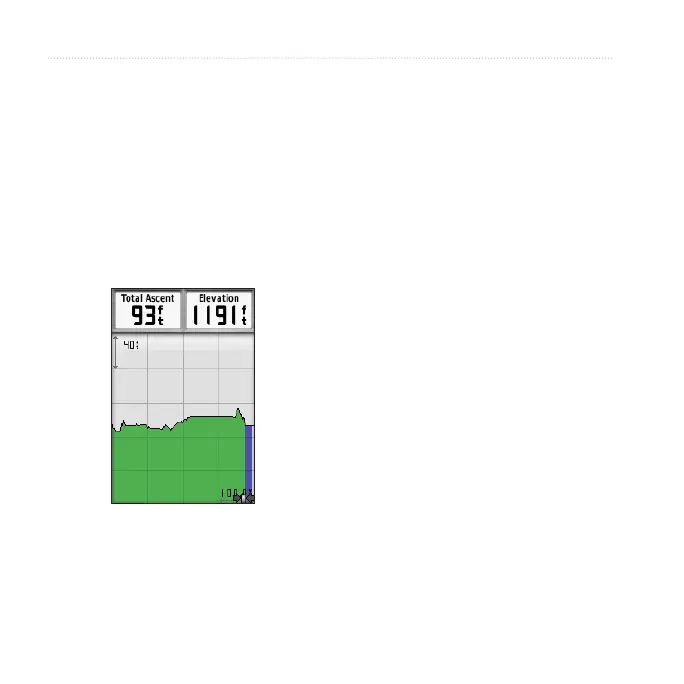
By default, the elevation plot displays
the elevation for distance. To customize
the elevation plot, see page 52.
1. From the main menu, select Tools >
Elevation Plot.
2. Press left or right on the Rocker to
scroll across the plot.
3. Select individual points on an
elevation plot or a pressure plot to
view the elevation (or pressure)
reading, the time of day, and the
date when the point was recorded.
1. From the main menu, select Tools >
Elevation Plot.
2. Press left or right on the Rocker to
scroll across the plot.
3. Press ENTER.
The point appears on the map with
location coordinates, the compass
bearing, and the distance from your
current location.
4. Press MARK to save the point as a
waypoint.
5. Navigate to the waypoint (page 21).
1. From the main menu, select Tools >
Elevation Plot.
 Loading...