EasyManuals Logo

Garmin Astro 320 User Manual

Garmin Astro 320
80 pages
To Next Page IconTo Next Page
To Previous Page IconTo Previous Page
Page #34 background imageLoading...
Page #34 background image
34 Astro 320 and DC40 Owner’s Manual
Navigation Tools

Navigation tools include features that
compliment the GPS functions of the
Astro.
Compass (page 34)
Sight ‘N Go (page 36)
Trip computer (page 37)
Elevation plot (page 38)
Proximity alarms (page 39)
Area calculation (page 39)
Satellite (page 40)

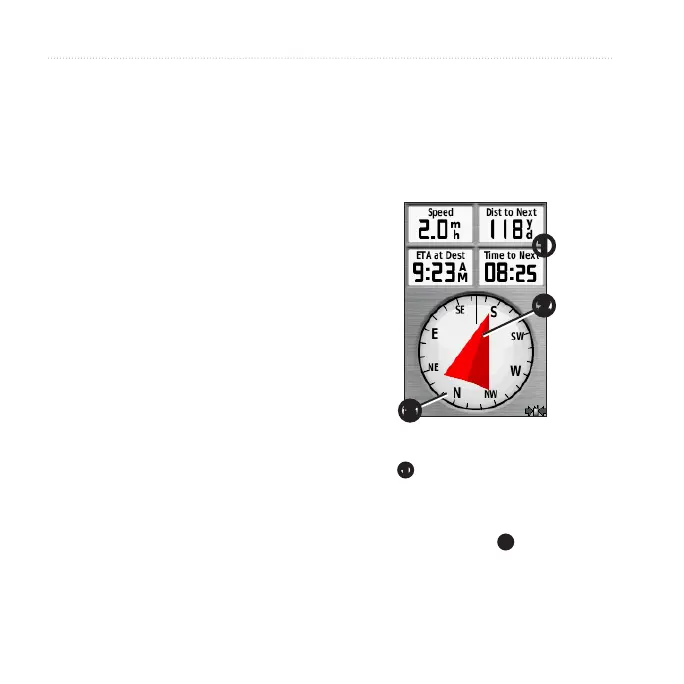
The Astro has a 3-axis electronic
compass.

1. From the main menu, select Tools >
Compass.
2. Turn toward the direction of the
bearing pointer until the arrow
is pointing toward the top of the
compass.

The compass provides navigation
data
such as current speed and
estimated arrival time.
When navigating to a destination,
the bearing pointer
points to
your destination, regardless of the
direction you are moving. When

Table of Contents

Other manuals for Garmin Astro 320

Questions and Answers:

Question and Answer IconNeed help?

Do you have a question about the Garmin Astro 320 and is the answer not in the manual?

Garmin Astro 320 Specifications

General IconGeneral
PurposePET
Product colorBlack, Blue, Red
Electronic compass-
Pre-installed mapsČeské republiky
Built-in displayYes
Battery life (max)- h
Cables includedAC, CI, USB
Weight and Dimensions IconWeight and Dimensions
Weight- g

Related product manuals