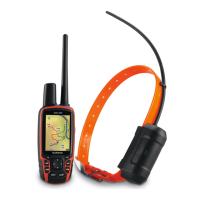
Astro 320 and DC40 Owner’s Manual 49
Customizing Your Device
From the main menu, select Setup >
Map.
• Orientation
◦ North Up—shows north at the
top of the page.
◦ Track Up—shows your current
direction of travel toward the
top of the page.
• Guidance Text—allows you to
select when to show guidance text
on the map.
• Data Fields—page 69.
• Advanced Map Setup—sets the
zoom levels, the text size, and the
detail level of the map.
◦ Auto Zoom—automatically
selects the appropriate zoom
level for optimal use on your
map. When Off is selected, you
must zoom in or out manually.
◦ Zoom Levels—selects the zoom
level for map items.
◦ Text Size—selects the text size
for map items.
◦ Detail—selects the amount
of detail shown on the map.
Showing more detail may cause
the map to redraw more slowly.
◦ Shaded Relief—shows detail
relief on the map (if available)
or turns off shading.
• Map Information—allows you to
enable or disable the maps currently
loaded on the device. To purchase
additional maps, see page 67.
 Loading...