Garmin Pilot for iOS User’s Guide
190-01501-00 Rev. F
133
Fly
Overview Plan File Fly Subscriptions Appendices Index
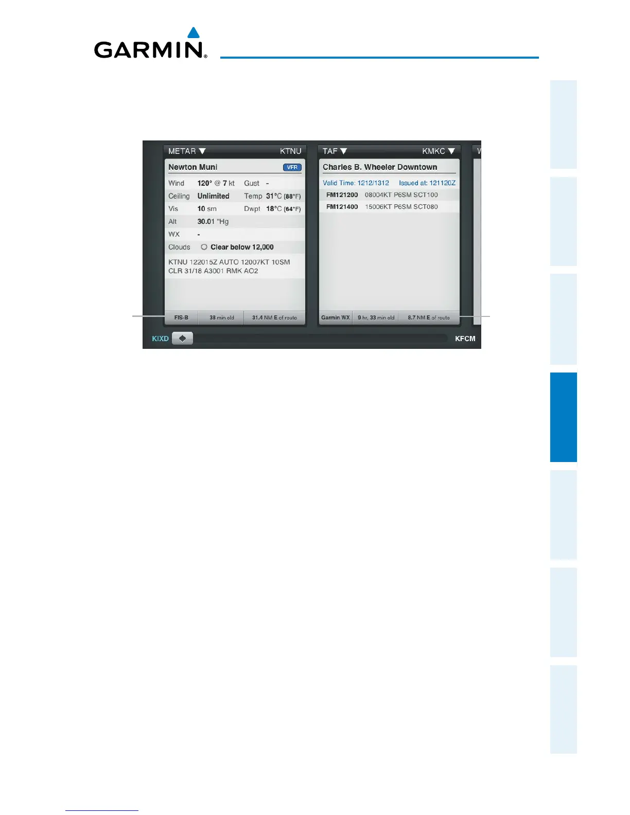
when the data was assembled on the ground and the current GPS time. Garmin Pilot
combines the CONUS and Regional Radar into one map overlay, the time shown is for
the Regional Radar product only.
Weather Product Age and Source
Weather
Product
Source,
Age and
Relative
Location
Cached
Unexpired
Weather
Data
NEXRAD
Weather radar data is collected from radar sites across the United States. It is
combined into a mosaic for easier display and analysis. Garmin Pilot combines the
CONUS and Regional Radar FIS-B products into one map overlay (Radar (FIS-B)).
The radar data displayed is not real-time. The lapsed time between collection,
processing, and dissemination of radar images can be significant and may not reflect
the current radar synopsis. Due to the inherent delays and the relative age of the
data, it should be used for long-range planning purposes only. Never use radar data
to maneuver in or near areas of hazardous weather. Rather, use it in an early-warning
capacity for pre-departure evaluation.
Composite data from radar sites in the United States is shown. This data is composed
of the maximum reflectivity from the individual radar sweeps at different title angels
of the radar beam with respect to the ground. The display of the information is color-
coded to indicate the weather severity level. Colors are used to identify the different
echo intensities (reflectivity) measured in dBZ (decibels or Z). “Reflectivity” (designated
by the letter Z) is the amount of transmitted power returned to the radar receiver. The
dBZ values increase as returned signal strength increases. Precipitation intensity is
displayed using colors corresponding to the dBZ values.
 Loading...