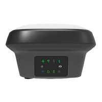
Type Horizontal Vertical
Static with long observa-
tions
3 mm + 0.1 ppm 3.5 mm + 0.4 ppm
Type Horizontal Vertical
Single Baseline (<30 km) 8 mm + 1 ppm 15 mm + 1 ppm
Network RTK 8 mm + 0.5 ppm 15 mm + 0.5 ppm
Tilt compensated in real-time
Additional Hz pole tip uncertainty:
Typically less than 8 mm + 0.4 mm/° tilt down to 30° tilt for topographic
points (not for static control points)
Typically 2 cm to 4 cm (2D) within the distance of 2 m to 10 m between the
camera and the object
The accuracy depends on the prevailing GNSS accuracy and the type of the
trajectoy.
A curve in the trajectory increases the accuracy of an image point measure-
ment.
6.1.3 Technical Data
Height: 0.109 m
Length: 0.173 m
Width: 0.173 m
Instrument weight without battery, SIM card and SD card:
Type Weight [kg]/[lbs]
GS18 I 1.25/2.75
GS18 T 1.23/2.71
GS18 1.20/2.65
Data (Leica GNSS raw data and RINEX data) can be recorded on the internal
memory or on the SD card.
1 GB is sufcient for over 1 year of raw data logging based on logging every
15 s from an average of 15 satellites.
Power consumption:
Radio excluded: 3.5 W typically, 300 mA (with
external battery), 320 mA (with internal battery)
External supply
voltage:
Nominal 12 V DC (⎓, GEV71 car battery cable to a
12 V car battery), voltage range 12 V‑24 V DC
Type Battery Voltage Capacity Operating time, typical*
GEB331 Li-Ion 11.1 V 2.8 Ah 8 h
Differential phase in
real-time
Tilt
Imaging
Dimensions
Weight
Recording
Power
Internal battery
Technical Data 53

 Loading...