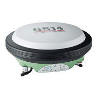
1.2 Denition of Use
•
Computing with software
•
Recording measurements
•
Carrying out measurement tasks using various GNSS measuring techniques
•
Recording GNSS and point related data
•
Remote control of product
•
Data communication with external appliances
•
Measuring raw data and computing coordinates using carrier phase and
code signal from GNSS satellites (GNSS systems)
•
Capturing image groups and computing 3D coordinates of points using
images
•
Use of the product without instruction
•
Use outside of the intended use and limits
•
Disabling of safety systems
•
Removal of hazard notices
•
Opening the product using tools, for example a screwdriver, unless this is
permitted for certain functions
•
Modication or conversion of the product
•
Use after misappropriation
•
Use of products with recognisable damage or defects
•
Use with accessories from other manufacturers without the prior explicit
approval of Leica Geosystems
•
Inadequate safeguards at the working site
•
Controlling of machines, moving objects or similar monitoring applications
without additional control and safety installations
1.3 Limits of Use
Suitable for use in an atmosphere appropriate for permanent human habita-
tion. Not suitable for use in aggressive or explosive environments.
WARNING
Working in hazardous areas, or close to electrical installations or sim-
ilar situations
Life Risk.
Precautions:
▶
Local safety authorities and safety experts must be contacted by the
person responsible for the product before working in such conditions.
1.4 Responsibilities
Leica Geosystems AG, CH-9435 Heerbrugg, hereinafter referred to as Leica
Geosystems, is responsible for supplying the product, including the User
Manual and original accessories, in a safe condition.
Intended use
Reasonably
foreseeable misuse
Environment
Manufacturer of the
product
Safety Directions 7

 Loading...