4. AIS OPERATION
4-12
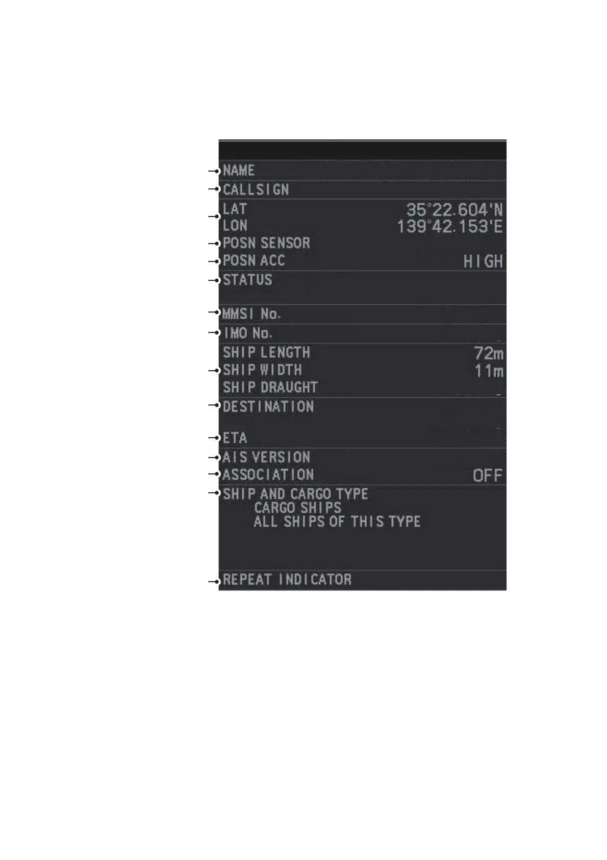
4.9.3 How to display expanded AIS target data
The expanded AIS data display provides additional information about an AIS target,
including call sign, IMO No., etc. To display expanded AIS data, show the basic data
for a target, then left-click the target data display. The expanded data appears.
If data for an item is unknown, "missing" appears.
4.9.4 How to remove target data from the display area
Place the cursor on a desired tracked target and press the TARGET CANCEL key.
The select target’s data is no longer displayed in the data display area.
Note:
Navigation status is not available for Class B targets. Where the selected AIS
target is an aircraft, the
[
STATUS
]
box shows the aircraft’s altitude.
12345678901234567890
1234567
GPS GLONASS
POWE-DRIVEN VESSEL
(AHEAD/ALONGSIDE)
123456789
123456789
25.4m
12345678901234567890
23:59 31/DEC
1
1
EXPANDED DATA
Vessel name
Call sign
Position
Type of position sensor
Position accuracy
Navigation status
MMSI number
IMO number
Vessel dimensions
Destination
ETA at destination
AIS transponder version
Association (ON or OFF)
Ship and cargo type
Repeat indicator
 Loading...