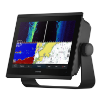
Measuring a Distance on the Chart
1 From a chart, select a location.
2 Select Measure.
A push pin appears on the screen at your present location. The distance and angle from the pin is listed in
the corner.
TIP: To reset the pin and measure from the current location of the cursor, select Set Reference.
Creating a Waypoint on the Chart
1 From a chart, select a location or object.
2 Select .
Viewing Location and Object Information on a Chart
You can view information, such as tide, current, celestial, chart notes, or local services, about a location or an
object on the Navigation chart or the Fishing chart.
1 From the Navigation chart or Fishing chart, select a location or object.
A list of options appears. The options that appear vary based on the location or object you selected.
2 If necessary, select .
3 Select Information.
Viewing Details about Navaids
From the Navigation chart, Fishing chart, Perspective 3D chart view, or Mariner’s Eye 3D chart view, you can
view details about various types of navigation aids, including beacons, lights, and obstructions.
NOTE: The Fishing chart is available with premium charts, in some areas.
NOTE: 3D chart views are available with premium charts, in some areas.
1 From a chart or 3D chart view, select a navaid.
2 Select the name of the navaid.
Charts and 3D Chart Views 27
 Loading...