NX501E/NZ501EEnglish15
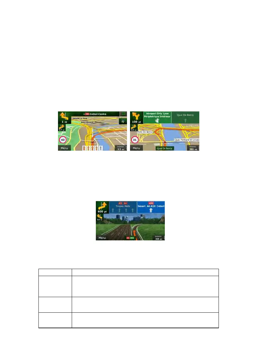
2.2.3.3LaneinformationandSignposts
When navigatingon multilane roads, it is important to take the appropriate lane inorder to
followtherecommendedroute.Iflaneinformationisavailableinthemapdata,ClarionMobile
Map displays the lanes and their directions using small arrows at the bottom of the map.
Highlightedarrowsrepresentthelanesyouneedtotake.
Where additional information is available, signposts substitute arrows. Signposts are
displayedatthetopofthemap.The colourandstyleofthesignpostsaresimilartothereal
onesyoucanseeabove roador bytheroadside.Theyshow theavailabledestinationsand
thenumberoftheroadthelaneleadsto.
All si gnposts look similar when cruising (when there is no recommended route). When
navigatingaroute,onlythesignpostthatpointstothelane(s)tobetakenisdisplayedinvivid
colours;allothers aredarker.
If you wantt o hide the currently displayed signposts, tap anyof them and the normalMap
screenreturnsuntilnewsignpostinformationisreceived.
2.2.3.4Junctionview
Ifyouareapproachingamotorwayexitoracomplexintersectionandtheneededinformation
exists,the map is replacedwith a 3D v iew of the junction.The lanes you need to take are
displayedwitharrows.Signpostscanalsobepresentifinformationisavailable.
If you want to hide the currently displayed junction, tap the picture and the Map screen
returns.
2.2.3.53Dobjecttypes
ClarionMobileMapsupportsthefollowing3Dobjecttypes:
Type Description
3Dterrain 3Dterrainmapdatashowschangesinterrain,elevationsordepressionsin
thelandwhenyouviewthemapin2D,anduseittoplottheroutemapin
3Dwhenyounavigate.Hillsandmountainsareshowninthebackgroundof
the3Dmap,andillustratedbycolourandshadingonthe2Dmap.
Elevatedroads
Complexintersectionsandverticallyisolatedroads(suchas overpassesor
bridges)aredisplayedin3D.
3Dlandmarks
Landmarks are 3D artistic or block representations of prominent or well-
knownobjects.

 Loading...