16NX501E/NZ501EEnglish
Type Descripti on
3Dbuildings
3D block representation of full city building data containing actual building
sizeandpositiononthemap.
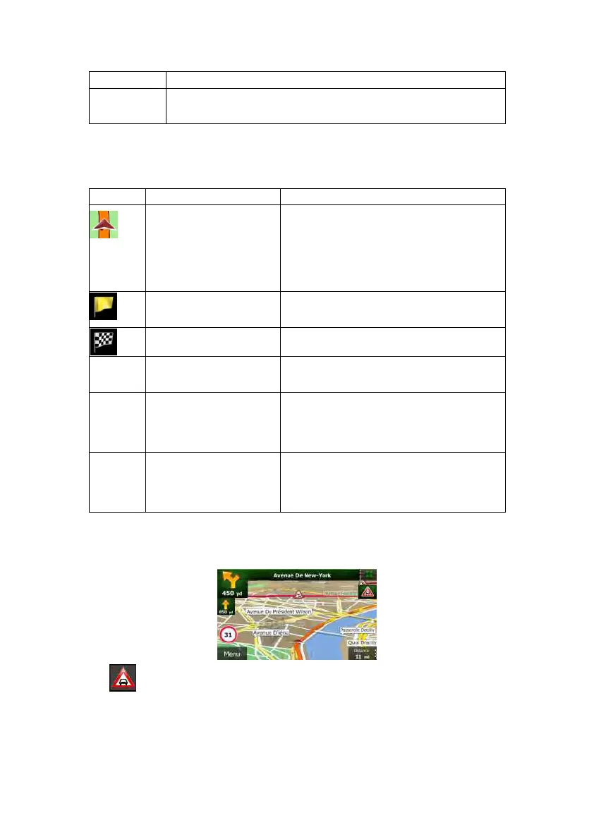
2.2.3.6Elementsoftheactiveroute
ClarionMobileMapshowstherouteinthefollowingway:
Symbol Name Description
CurrentGPSpositionand
Startpoint
Your current position di splayed on the map. If
roadsarenear,itisalignedtothenearestroad.
Normally if GPS position is a vailable, the route
startsfromthecurrentposition.Ifthereisnovalid
GPS position, Clarion Mobile Map uses the last
knownpositionasthestartpoint.
Waypoint(intermediate
destination)
An intermediate destination of the route before
reachingthefinaldestination.
Destination(endpoint) Thefinaldestinationoftheroute.
Routecolour
Theroutealwaysstandsoutwithitscolouronthe
map,bothindaytimeandinnightcolourmode.
Streetsandroadsthatare
excludedfromthenavigation
Youcanchoosewhetheryouwanttouseoravoid
certainroadtypes(page73).However,when
ClarionMobileMapcannotavoidsuchroads,the
routewillincludethemanditwillshowthemina
colourthatisdifferentfromtheroutecolour.
Streetsandroadsthatare
affectedbytrafficevents
Roadsegmentsmaybeaffectedbytrafficevents
received.Thesestreetsandroadsaredisplayed
inanalternatecolour,andsmallsymbols
displayedalongtherouteshowthetypeofthe
trafficevent.
2.2.3.7Trafficevents
Roadsegmentsaffectedbytrafficeventsaredisplayedwithanalternatecolouronthemap,
andsmallsymbolsabovetheroadshowthenatureoftheevent:
Tap toopentheTrafficSummaryscreen.

 Loading...