Garmin aera 760 Pilot’s Guide
190-02674-00 Rev. B
155
Additional Features
Overview Navigation Flight Planning Hazard Avoidance Additional Features Appendices Index
Expand/
Reduce
Button
Charts
Tab
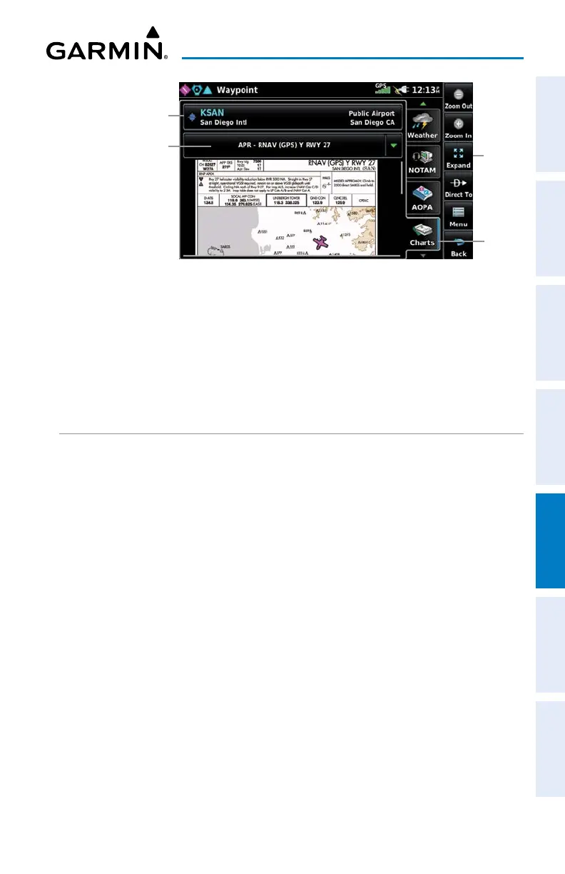
Waypoint Information Page (Charts Tab)
Waypoint Identifier Button
(Touch to change airport)
Chart Button
(Touch to select chart)
Changing the chart color mode:
1)
From the Main Menu, touch Tools > Setup > Display.
2)
Touch the 'Chart Color Mode' Data Option Button, and touch the desired
option from the list (Day, Night, or Auto).
GEO-REFERENCED AIRCRAFT POSITION AND CHART
OVERLAY
The geo-referenced aircraft position is placed on the chart when a position is
established. On the Map Page, the chart overlay and geo-referenced position are
shown when the aircraft is in the air (such as, speed is greater than 30 knots). Typically,
SIDs and STARs are not geo-referenced and thus will not typically display the ownship
symbol on those charts.
Displaying the chart overlay on the Map Page:
Fro
m the Main Menu, touch Map > Menu > Charts.
Adjusting the chart overlay opacity:
1)
From the Main Menu, touch Tools > Setup > Map.
2)
Touch the 'Chart Overlay Opacity' Data Option Button, and touch the
desired percentage.
 Loading...