EasyManuals Logo

Garmin Aera 760 User Manual

Garmin Aera 760
264 pages
To Next Page IconTo Next Page
To Previous Page IconTo Previous Page
Page #37 background imageLoading...
Page #37 background image
Garmin aera 760 Pilot’s Guide
190-02674-00 Rev. B
21
Overview
Overview Navigation Flight Planning Hazard Avoidance Additional Features Appendices Index
Flight plan legs
User waypoints
Track vector
Topography data
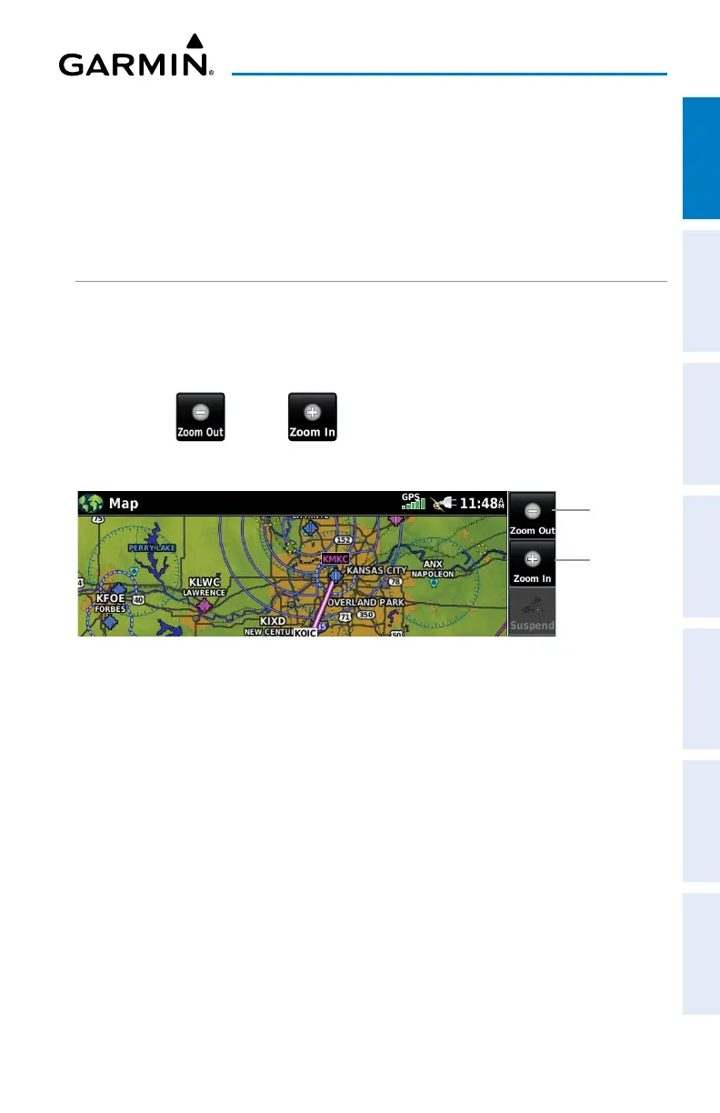
MAP RANGE
There are 23 different map ranges available, from 200 feet to 800 nm. The current
map range is indicated in the lower right. The scale bar represents the map scale.
Changing the map range:
Use the (out) or (in) icons to zoom ‘out’ (increasing), or zoom
‘in‘ (decreasing).
Zoom Out
Zoom In
Or
:
Pi
nch fingers together (zoom out), or pull fingers apart (zoom in).
AUTOZOOM
Autozoom allows the aera 760 to change the map display range to the smallest
range clearly showing the active waypoint. Autozoom can be overridden by adjusting
the range and remains that way until the active waypoint changes, a terrain or traffic
alert occurs, or the aircraft takes off.
Enabling/disabling Autozoom:
1)
From the Main Menu, touch Map > Menu > Set Up Map.
2)
If necessary, touch the Map Group Button and touch General.

Table of Contents

Questions and Answers:

Question and Answer IconNeed help?

Do you have a question about the Garmin Aera 760 and is the answer not in the manual?

Garmin Aera 760 Specifications

General IconGeneral
Display Size7 inches
Resolution1024 x 600 pixels
Battery LifeUp to 4 hours
ConnectivityWi-Fi, Bluetooth, USB
WAAS ReceiverYes
Weather SupportYes, with subscription
Voice ControlNo
Display TypeTouchscreen
Preloaded MapsYes, worldwide
GPS ReceiverHigh-sensitivity receiver
ChartsAviation charts
Data SubscriptionRequired for some features
Traffic SupportYes, with subscription
Mounting OptionsSuction cup, yoke mount

Related product manuals