Garmin aera 760 Pilot’s Guide
190-02674-00 Rev. B
25
Overview
Overview Navigation Flight Planning Hazard Avoidance Additional Features Appendices Index
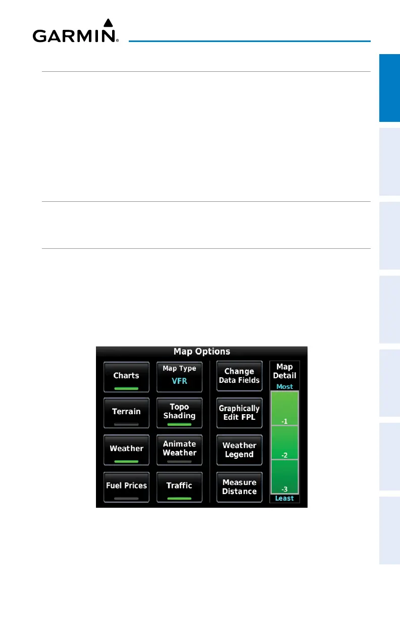
MAP OVERLAYS
The VFR, IFR, Terrain, Topography, Weather, Fuel Prices, or Traffic map overlays can
be displayed or removed.
Displaying/removing map overlays:
1)
From the Main Menu, touch Map > Menu.
2)
Touch VFR, IFR, Terrain, Topo Shading, Weather/Animate Weather,
Fuel Prices, or Traffic to display or remove the map overlay.
MAP SYMBOLS
Refer to Appendix H for a list of map symbols.
MAP DETAIL
The map can be adjusted to declutter the map.
Adjusting the declutter level of the Navigation Map:
1)
From the Main Menu, touch Map > Menu.
2)
Touch the desired Map Detail level (-1, -2, -3) on the right side of the
screen. The currently selected level is highlighted green.
Map Detail
 Loading...