EasyManuals Logo

Garmin Aera 760 User Manual

Garmin Aera 760
264 pages
To Next Page IconTo Next Page
To Previous Page IconTo Previous Page
Page #187 background image
Garmin aera 760 Pilot’s Guide
190-02674-00 Rev. B
Appendix B
171
Overview Navigation Flight Planning Hazard Avoidance Additional Features Appendices Index
APPENDIX B: ABNORMAL OPERATION
LOSS OF GNSS POSITION
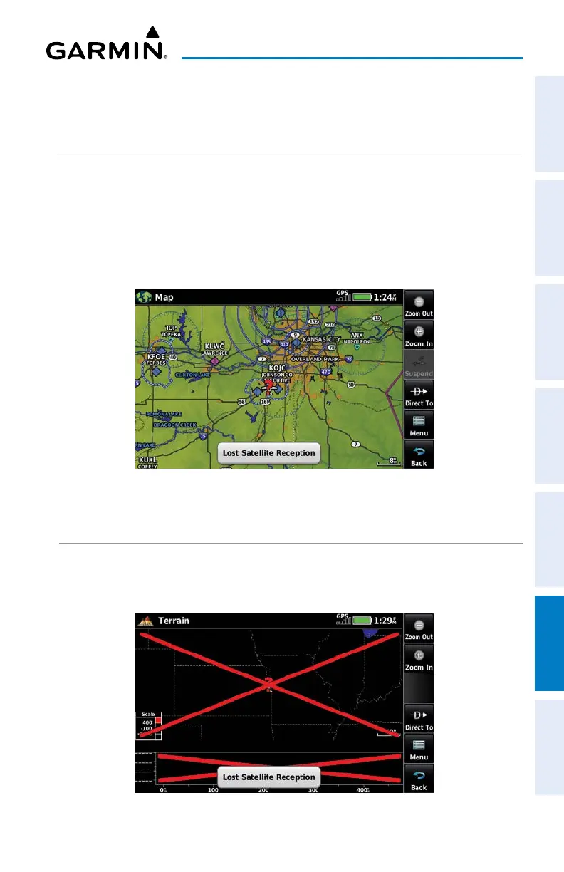
When the
aera 760 loses the GNSS signal for any reason, the following will occur:
A flashing red question mark will appear over the airplane icon on the map.
The ‘Lost Satellite Reception’ message will display.
Any GNSS dependent data fields will not be available.
GNSS Signal Lost
HAZARD DISPLAY WITH LOSS OF GNSS POSITION
If the Terrain function doesn’t have at least a 3D fix (i.e. altitude unknown),
a Red X will be displayed.
Terrain Red X

Table of Contents

Questions and Answers:

Question and Answer IconNeed help?

Do you have a question about the Garmin Aera 760 and is the answer not in the manual?

Garmin Aera 760 Specifications

General IconGeneral
Display Size7 inches
Resolution1024 x 600 pixels
Battery LifeUp to 4 hours
ConnectivityWi-Fi, Bluetooth, USB
WAAS ReceiverYes
Weather SupportYes, with subscription
Voice ControlNo
Display TypeTouchscreen
Preloaded MapsYes, worldwide
GPS ReceiverHigh-sensitivity receiver
ChartsAviation charts
Data SubscriptionRequired for some features
Traffic SupportYes, with subscription
Mounting OptionsSuction cup, yoke mount

Related product manuals