Garmin aera 760 Pilot’s Guide
190-02674-00 Rev. B
58
Navigation
OverviewNavigationFlight PlanningHazard AvoidanceAdditional FeaturesAppendicesIndex
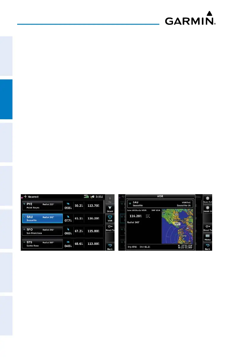
• USR WPT (User Waypoints)—name, bearing, and distance.
• City—name, bearing, and distance.
• ARTCC (Air Route Traffic Control Center)—bearing, distance, and frequency.
• FSS (Flight Service Station)—name, bearing, distance, frequency, and VOR (if
applicable).
• Airspace—name, time to entry (when applicable), and status.
Viewing nearest information:
1)
From the Main Menu, touch Nearest.
2)
Touch the Dedicated Page Icon on the Button Bar, and touch the desired
Nearest Icon (Airport, Apt WX, VOR, NDB, INT, User WPT, City,
ARTCC, FSS, or Airspace).
3)
Touch the desired nearest option from the list for additional information.
Or
:
If viewing Nearest ARTCCs or FSSs, touch Multiple Freqs... to view
additional frequencies.
4)
Touch the Back Icon to return to the previous page.
Nearest VORs List Additional VOR Information
NEAREST AIRPORT CRITERIA
The pilot can define the minimum runway length and surface type used when
determining the 15 nearest airports to display. A minimum runway length and/or
surface type can be entered to prevent airports with small runways or runways that
are not appropriately surfaced from being displayed. Default settings are 0 feet (or
meters) for runway length and "Any" for runway surface type. Private airports and
Heliports can also be included.

 Loading...