3-10
Map Creation Overview
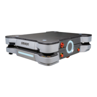
A map is a scanned representation of the floor plan in the AMR's operating space. Maps contain the
static features in the AMR's environment, such as walls, doors, permanent shelving, etc. They also
contain user-definable sectors, lines, and areas that help the AMR perform its job. Maps also contain a
variety of goals, routes, and tasks that comprise the destinations and activities of the AMR in the work-
space.
Before you can use your AMR, you must create a digitized map of its designated workspace. The map
records the shape and location of permanent physical features in the workspace. These features are
walls, corners, doors, columns and large immovable fixtures such as machines or fixed industrial
shelving.
WARNING
Objects in the environment protruding out, above, or below the AMR lasers' scanning
planes shall be configured as restricted zones during workspace map creation. This
will minimize possible collision risk during operation.
Precautions for Correct Use
For optimal performance of an MD-series AMR in a fleet, use a map created by an MD-series
AMR for the area in which it operates.
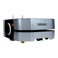
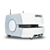
The AMR's front Safety Laser Scanner scans the workspace to create the map. The front laser scans
only a narrow horizontal plane, parallel to the floor. The scanning plane height is 175 mm above the
floor, so the laser cannot detect physical features above or below this plane, or features that are out of
operating range and resolution. This means that some features are not recorded on the map such as
overhanging objects like shelves or tables with narrow supporting legs. Other features that are below
the scanning plain may not be recorded, such as low lying objects like a column base or a pallet that
contains no cargo.
Moving objects such as fork-lift trucks and carts, or transient objects such as pallets loaded with finish-
ed goods do not provide useful mapping data. Erase such objects from the map after you create it.
If the workspace has open stairwells, docks, ledges or other vertical drops, make sure that you sur-
round such areas with physical barriers. Barriers must be detectable by the Safety Laser Scanner's
scanning plane, which are at a height of 175 mm from the floor. Install the barriers before mapping a
workspace.
A connected Pendant is required to drive the AMR while creating the map. Refer to 4-23-1 Driving with
the Pendant on page 4-49 for more information.
To ensure the map is accurate, drive the AMR under the following conditions.
• Drive in a way that the laser in the front, right corner of the AMR is exposed to objects while consid-
ering that it has a limited field of view. Keep objects to the right of the AMR as much as possible as
you approach and drive around them. This ensures that the front laser detects the object completely
and objects are mapped accurately.
3 Installation
3-38
AMR (Autonomous Mobile Robot) MD-series Platform User's Manual (I681)
 Loading...