6.10Chartlayers
Thecharthasanumberofcontentlayersanddisplaymodes
providingdifferentkindsofdisplayandinformation.
Youcanoverlaydataontoachartwindowtogivegreaterdepthof
information.Theoverlaysavailableare:
•Aerialoverlay.Providesanaerial/satellitephotographyoverlay.
•NowRadweather(2Dviewonly)—ProvidestheNowRadweather
radaroverlay,withouttheneedtoopenaseparateweather
applicationwindow.
•Weatherreports(2Dviewonly)—Providesweatherreports,
withouttheneedtoopenaseparateweatherapplicationwindow.
•Radaroverlay(2Dviewonly)—Overlayradarontothechart.
•AIST argets(2Dviewonly)—ViewandtrackAIStargets.
•AdjustExaggeration(3Dviewonly)—Adjustthe3Drelief.
•Waypointnames(3Dviewonly)—Viewwaypointnameson
thechart.
Note:Thelayersrequireelectronicchartswiththeappropriate
featuresupportandmayalsorequireadditionalhardwareand
servicesubscriptions.
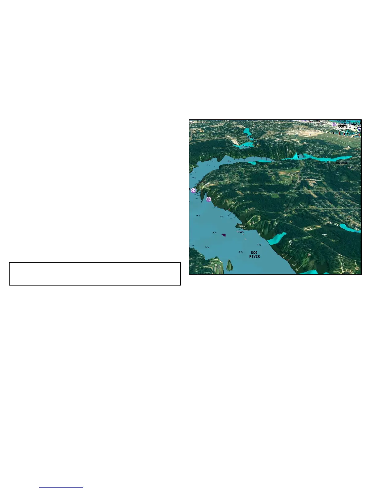
Aerialphotooverlay
Yourelectronicchartsmayincludeaerialphotography.
Aerialphotoscoverthenavigablewatersupto3milesinsidethe
coastline.Theresolutionisdependentontheregioncoveredby
thechartcard.
Enablingaerialphotooverlay
Inthechartview:
1.Selectthe2DCHARTLAYERSor3DCHARTLAYERSsoftkey
asappropriate.
2.UsetheAERIALOVERLAYsoftkeytoselecttheONoption.
84E-SeriesWidescreenUserreference
 Loading...