3-SETUP
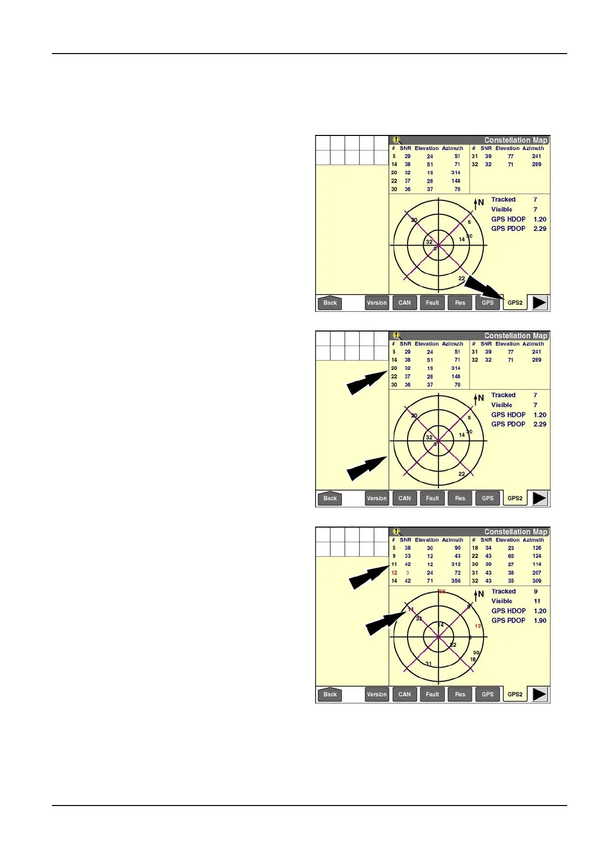
"ConstellationMap"screen
NOTE:ThisscreenisonlyactivewhentheinstalledGPSreceiveriscapableofreceivingNationalMarineElectronics
Association(NMEA)sentencesoftheGSV(satellitesinview)type.TheseincludetheAFS162,AFS252,AFS262,
andAFS372receiversandTrimble®equivalents.
Pressthe“GPS2”icononthenavigationbartodisplaythe
“ConstellationMap”screen.
RAIL12DSP1424BA1
Thescreenisdividedintoanuppertableareaandalower
maparea.Bothareasprovidevaluableinformationonthe
numberofsatellitesthatarecurrentlyvisibleandtracked
(inuse)bytheGPSreceiver.
Thetableareadisplaysinformationaboutamaximumof
10satellites.Eachsatelliteisidentiedbyitsnumber.The
numberisblackwhenthesatelliteistracked(inuse)and
redwhenthesatelliteisonlyvisible(notinuse).
NOTE:Asatellitecanbevisible,butnottracked,because
itssignalistoopoor.
RAIL12DSP1424BA2
Foreachtrackedsatellite,thetableprovidesitsSignal-
to-NoiseRatio(SNR),elevation,andazimuth.Foreach
visiblesatellite,thetableprovidesonlyitselevationand
azimuth;theSNRvalueisgrayedout.
Themapareabelowthechartvisuallyrepresentsthelo-
cationsofthesatellitesinrelationtothevehicleandtrue
north.Allvisibleandtrackedsatellitesareshownand
identiedbytheirnumberinthesameblackandredcolor
code.
NOTE:Thevehiclelocationisalwaysattheverycenter
ofthemap.
RAIL12DSP1425BA3
3-95

 Loading...