ItemDescription
1
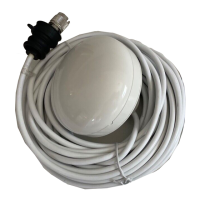
Skyview—avisualrepresentationofthepositionoftracked
satellites.
2
HorizontalDilutionofPosition(HDOP)—ameasureof
GPSaccuracy,calculatedfromanumberoffactorsincluding
satellitegeometry,systemerrorsinthedatatransmissionand
systemerrorsintheGPSreceiver.Ahigherguresigniesa
greaterpositionalerror.AtypicalGPSreceiverhasanaccuracy
ofbetween5and15m.Asanexample,assumingaGPS
receivererrorof5m,anHDOPof2wouldrepresentanerror
ofapproximately15m.Pleaserememberthatevenavery
lowHDOPgureisNOguaranteethatyourGPSreceiveris
providinganaccurateposition.Ifindoubt,checkthedisplayed
vesselpositioninthechartapplicationagainstyouractual
proximitytoaknownchartedobject.
3
Fixstatus—indicatestheactualmodetheGPSreceiveris
reporting(NoFix,Fix,DFixorSDFix).
4
Datum—TheGPSreceiver’sdatumsettingaffectsthe
accuracyofthevesselpositioninformationdisplayedinthechart
application.InorderforyourGPSreceiverandmultifunction
displaytocorrelateaccuratelywithyourpapercharts,theymust
beusingthesamedatum.RefertotheUsingtheChartchapter
formoreinformation.
5
Mode—themodecurrentlyselectedbytheGPSreceiver.
6
Satellitestatus—displaysthesignalstrengthandstatusof
eachsatelliteidentiedintheSkyviewdiagramontheleftof
thescreen.
TheaccuracyoftheGPSreceiverdependsontheparameters
detailedabove,especiallytheazimuthandelevationangleswhich
areusedintriangulationtocalculateyourposition.
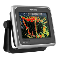
7.6Radarcheck
Warning:Radarscannersafety
Beforerotatingtheradarscanner,ensureallpersonnel
areclear.
Warning:Radartransmissionsafety
Theradarscannertransmitselectromagneticenergy.
Ensureallpersonnelareclearofthescannerwhen
theradaristransmitting.
Checkingtheradar
1.SelectaRadarpage.
TheRadarscannerswillnowinitializeinstandbymode,this
processwilltakeapproximately70seconds.
2.PressthePOWERbutton.
3.PresstheRadarTx/StdbysoftkeyandsettoTx.
Thescannersshouldnowbetransmittingandreceiving.
4.Checkthattheradarscreenisoperatingcorrectly.
Systemchecks
109
 Loading...