5. ROUTES
5-2
5.2 How to Create a Route
5.2.1 How to create a new route from the plotter screen
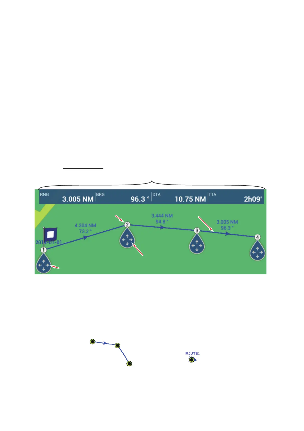
1. Tap a location on the screen for the 1st point in the route to display the pop-up
menu.
2. Tap [New Route]. The flag mark appears on the selected position and the route
information box appears (at the top of the screen).
Note: The route information box is hidden behind the status bar when an alarm
message appears in the status bar.
3. Tap the next route point in the route. A light-blue line with arrow runs between the
previous route point and the next route point. The arrow points in the direction of
route flow.
4. Tap the next route point in the route.
Repeat this step to enter all route points. Each route point is numbered.
The route information box shows the point’s range and bearing, the distance to
arrival and the time-to-go to the last waypoint.
5. At the last route point, tap [End Route] at the top right-hand corner of the screen
to complete the route.
6. The window for entering route name appears. Enter route name, then tap [] to
confirm. The route information box shows, to the last waypoint, the range, time-to-
go, estimated time of arrival and SOG.
Note 1: The route created above is called an "inactive route". When you create a new
route or tap another inactive route, that route becomes a "sleeping route".
Note 2: The route created by the above method cannot be saved to the routes list.
Route pointRoute point
1st route point (starting point)1st route point (starting point)
Route legRoute leg
Drag and drop to change
location of point
Drag and drop to change
location of point
Route information
- RNG: Range between last two points - BRG: Bearing between last two points
- DTA: Distance to Arrival - TTA: Time To Arrival
Inactive route Sleeping route
 Loading...