Garmin G1000 Pilot’s Guide for the Piper PA-32 Saratoga
190-02692-00 Rev. A170
FLIGHT MANAGEMENT
SYSTEM
OVERVIEW
FLIGHT
INSTRUMENTS
EIS
AUDIO PANEL
& CNS
FLIGHT
MANAGEMENT
HAZARD
AVOIDANCE
AFCS
ADDITIONAL
FEATURES
APPENDICESINDEX
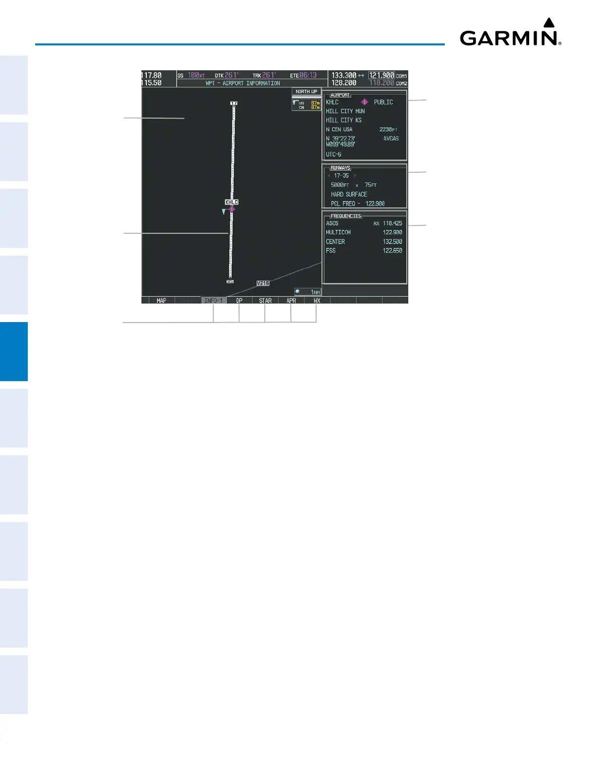
Figure 5-26 WPT – AIRPORT INFORMATION Page
Airport/Runway
Diagram
Selected Airport
Shown
Runway Information
– Designation
– Length/Width/Surface
– Lighting Available
Airport Information
– ID/Facility/City
– Usage Type/Region
– Lat/Long/Elev
– Fuel Available
– Time Zone (UTC Offset)
COM/NAV Freq. Info.
– Identification
– Frequency
– Availability
– Additional Information
Softkeys
The following descriptions and abbreviations are used on the WPT – AIRPORT INFORMATION Page:
- Usage type: Public, Military, Private, or Heliport
- Runway surface type: Hard, Turf, Sealed, Gravel, Dirt, Soft, Unknown, or Water
- Runway lighting type: No Lights, Part Time, Full Time, Unknown, or PCL Freq (for pilot-controlled lighting)
- COM Availability: TX (transmit only), RX (receive only), PT (part time), i (additional information available)
 Loading...