190-02692-00 Rev. A
Garmin G1000 Pilot’s Guide for the Piper PA-32 Saratoga
177
FLIGHT MANAGEMENT
SYSTEM
OVERVIEW
FLIGHT
INSTRUMENTS
EIS
AUDIO PANEL
& CNS
FLIGHT
MANAGEMENT
HAZARD
AVOIDANCE
AFCS
ADDITIONAL
FEATURES
APPENDICES INDEX
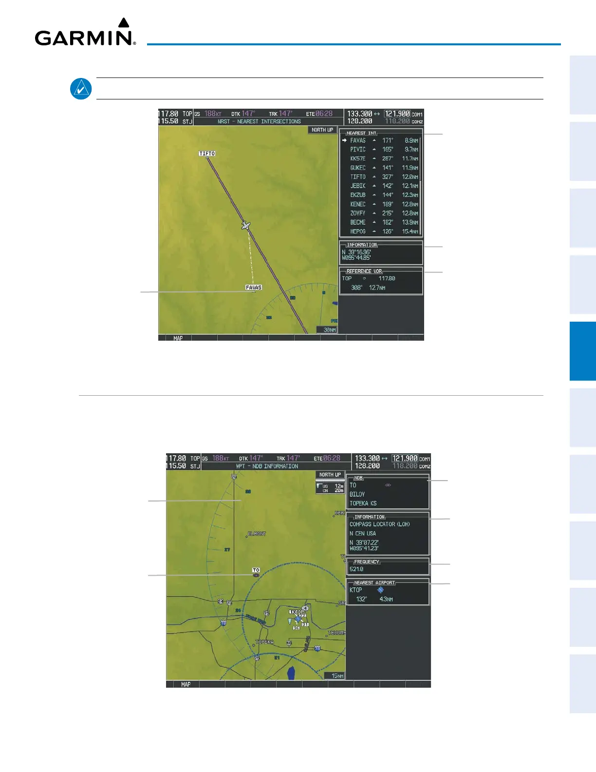
NOTE: The list only includes waypoints that are within 200 nm.
Figure 5-33 NRST – NEAREST INTERSECTIONS Page
Nearest Intersection
Intersection Information
– Identifier/Symbol
– Bearing/Distance to
intersection from
aircraft position
Reference VOR Info
– Identifier/Type (symbol)
– VOR Frequency
– Bearing/Distance to VOR
Intersection Lat/Long
NDBS
The WPT – NDB INFORMATION Page is used to view information about NDBs. In addition to displaying
a map of the currently selected NDB and surrounding area, the page displays NDB information in four boxes
labeled NDB, INFORMATION, FREQUENCY, and NEAREST AIRPORT.
Figure 5-34 WPT – NDB INFORMATION Page
Selected NDB
Navigation Map
Showing Selected
NDB
NDB Identifier/Type
– Facility Name
– Nearest City
Nearest Airport Info
– Identifier/Type (symbol)
– Bearing/Distance to Airport
NDB Information
– Type
– Region
– Lat/Long
NDB Frequency
 Loading...