Garmin G1000 Pilot’s Guide for the Piper PA-32 Saratoga
190-02692-00 Rev. A
340
HAZARD AVOIDANCE
SYSTEM
OVERVIEW
FLIGHT
INSTRUMENTS
EIS
AUDIO PANEL
& CNS
FLIGHT
MANAGEMENT
HAZARD
AVOIDANCE
AFCS
ADDITIONAL
FEATURES
APPENDICESINDEX
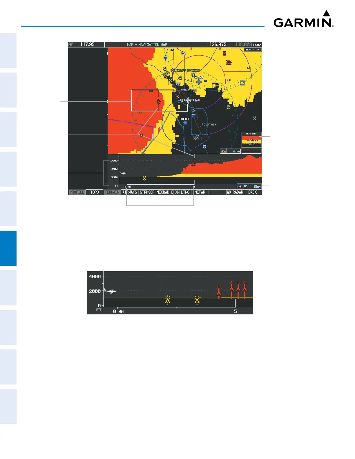
Terrain Legend
Profile View Length
is One Half of the
Navigation Map Range
Figure 6-78 Profile View on Navigation Map with Terrain Display Enabled
Altitude Scale
Distance Scale
Profile Path
Range
Markers
Navigation Map
Range
Obstacles with heights greater than 200 feet AGL appear relative to aircraft altitude along the altitude scale.
The top of the obstacle symbol on the scale represents the obstacle’s height AGL. If the obstacle’s height AGL
is higher than can be represented by the obstacle symbol itself (e.g. for unusually tall obstacles), a vertical line
appears below the obstacle symbol in order to depict the top of the obstacle symbol at its height AGL.
Figure 6-79 Profile View with Tall Obstacles
 Loading...