190-02692-00 Rev. A
Garmin G1000 Pilot’s Guide for the Piper PA-32 Saratoga
391
ADDITIONAL FEATURES
SYSTEM
OVERVIEW
FLIGHT
INSTRUMENTS
EIS
AUDIO PANEL
& CNS
FLIGHT
MANAGEMENT
HAZARD
AVOIDANCE
AFCS
ADDITIONAL
FEATURES
APPENDICES INDEX
Complete
Chart Shown
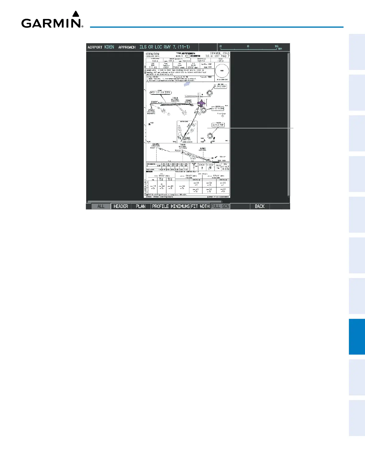
Figure 8-12 Approach Information Page,
» Pressing the HEADER Softkey shows the header view (approach chart briefing strip) on the screen.
» Pressing the PLAN Softkey shows the approach chart two dimensional plan view.
» Pressing the PROFILE Softkey displays the approach chart descent profile strip.
» Pressing the MINIMUMS Softkey displays the minimum descent altitude/visibility strip at the bottom of
the approach chart.
» If the chart scale has been adjusted to view a small area of the chart, pressing the FIT WDTH Softkey
changes the chart size to fit the available screen width.
» Pressing the FULL SCN Softkey alternates between removing and replacing the data window to the right.
» Pressing the BACK Softkey, or waiting for 45 seconds reverts mto the chart selection softkeys.
Selecting Additional Information:
1) While viewing the Airport Taxi Diagram, press the FULL SCN Softkey to display the information windows
(AIRPORT, INFO).
2) Press the
FMS
Knob to activate the cursor.
3) Turn the large
FMS
Knob to highlight the AIRPORT, INFO, RUNWAYS, or FREQUENCIES Box (INFO Box shown).
4) Turn the small FMS Knob to select the INFO Box choices. If multiple choices are available, scroll to the desired
choice with the large FMS Knob and press the ENT Key to complete the selection.
5) Press the
FMS
Knob again to deactivate the cursor.
Pressing the BACK Softkey, or waiting for 45 seconds reverts to the chart selection softkeys.
The full screen view can also be selected by using the page menu option.

 Loading...