 Loading...


Do you have a question about the Raymarine A65 and is the answer not in the manual?
| GPS | Yes |
|---|---|
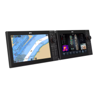
| Chartplotter | Yes |
| Radar Compatible | Yes |
| Sonar | Yes |
| Display Type | Color LCD |
| Chart Compatibility | Navionics |
Covers safe navigation practices, route generation limitations, and traffic separation rules.
Safety precautions for radar transmission, sonar operation, and touchscreen display usage.
Covers care for chart/memory cards, secure card reader, sun covers, and product cleaning.
Guides through startup wizard, boat details (depth, beam, height), time/date, data master, and GPS setup.
Instructions for saving, exporting, importing, and erasing waypoints, routes, tracks, and settings.
Introduces autopilot control features and guides on enabling it for different autopilot types.
Instructions on engaging, disengaging, and adjusting the autopilot's heading and modes.
Covers pilot set-up, vessel settings, drive settings, rudder alignment, and system monitoring.
Explains alarm types, color coding, acknowledging alarms, and using the Alarm Manager.
Details how to change alarm thresholds, enable/disable alarms, and clear alarm history.
Configures safety, general, switch panel, and engine alarms, including thresholds and options.
Explains how to activate, cancel MOB alarms, and the waypoint (MOB) button/icon.
Explains fuel manager overview, enabling/disabling, setting capacity, economy units, and fuel logging.
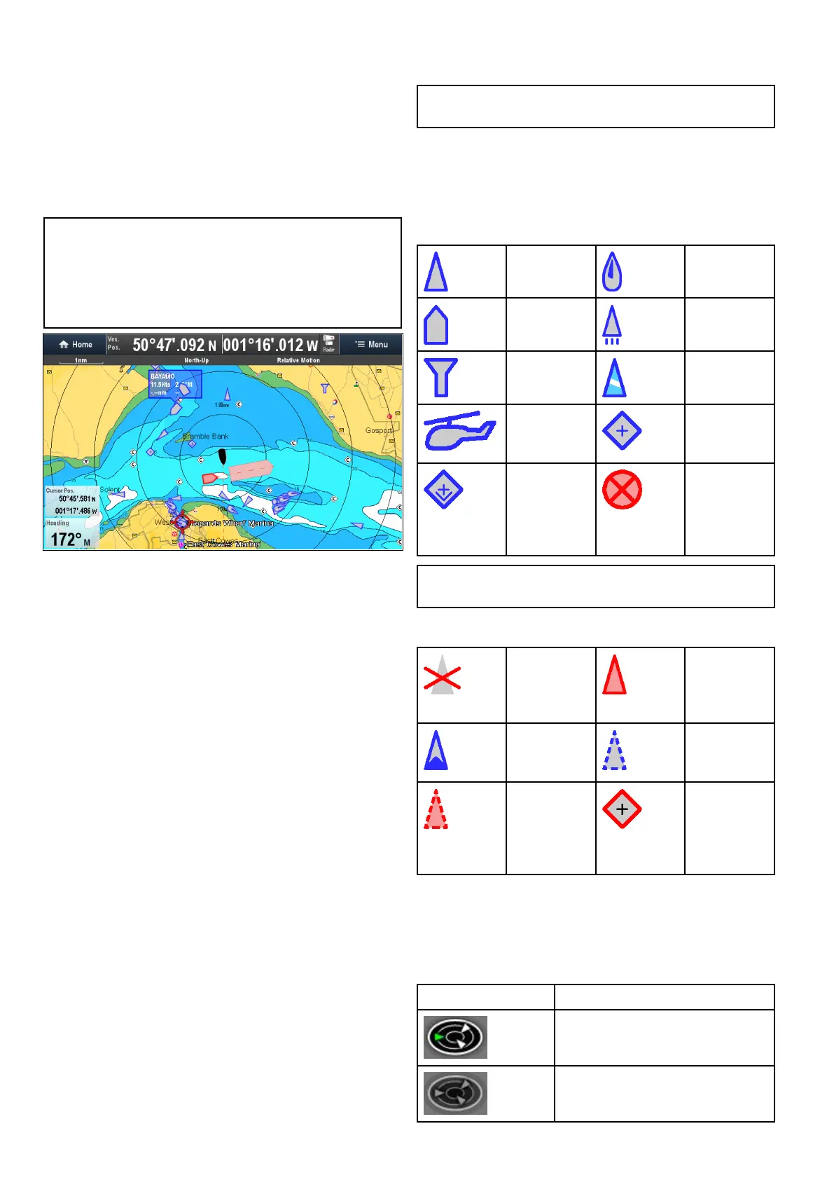
Details AIS overview, target types, status, symbols, and system prerequisites for functionality.
Details dangerous targets, collision avoidance features, target interception, and course/speed change examples.
Details waypoint display, context menu, placement, groups, searching, and symbols.
Covers route features, building routes, automatic route generation, review, editing, and troubleshooting.
Details chart application features for navigation, route planning, and electronic charts.
Details AIS, MARPA, Target Interception, Guard Zone Alarm, and Dangerous Targets for collision avoidance.
Details fishfinder features, sonar modules, selecting channels/transducers, and troubleshooting crosstalk.
Covers display modes (Zoom, A-Scope, Bottom Lock), sensitivity settings, gain, contrast, noise filter, alarms, and frequency tuning.
Details radar features, scanner types, sensitivity controls, gain modes, and status symbols.
Covers radar range, image quality factors (side lobes, echoes, clutter, interference), and maximum range.
Details collision avoidance features (AIS, MARPA) and MARPA operation and risk assessment.
Covers engine data display, identification wizard, and setting boat details like engines and fuel tanks.
Details camera application overview, changing feeds, switching streams, Quad View, and camera cycling.
Explains recording IP camera feeds, playback, taking photos, viewing images, and camera LED control.
Details thermal camera overview, image display, status icons, setup, and image adjustments.
Details fixed mount thermal camera overview, image display, status icons, setup, and image adjustments.
Covers enabling MFD Wi-Fi, connecting to access points/hotspots, and removing saved networks.
Provides general troubleshooting steps and solutions for power-up problems.
Covers troubleshooting for radar issues (no data, incorrect bearing) and GPS issues (no fix).
Addresses issues with automatic route generation and sonar problems (scrolling, depth, interference).
Covers troubleshooting for video, Wi-Fi, Bluetooth, touchscreen, and general erratic behavior.