Garmin G1000 Pilot’s Guide for the Socata TBM 850
190-00709-00 Rev. A1-20
SYSTEM OVERVIEW
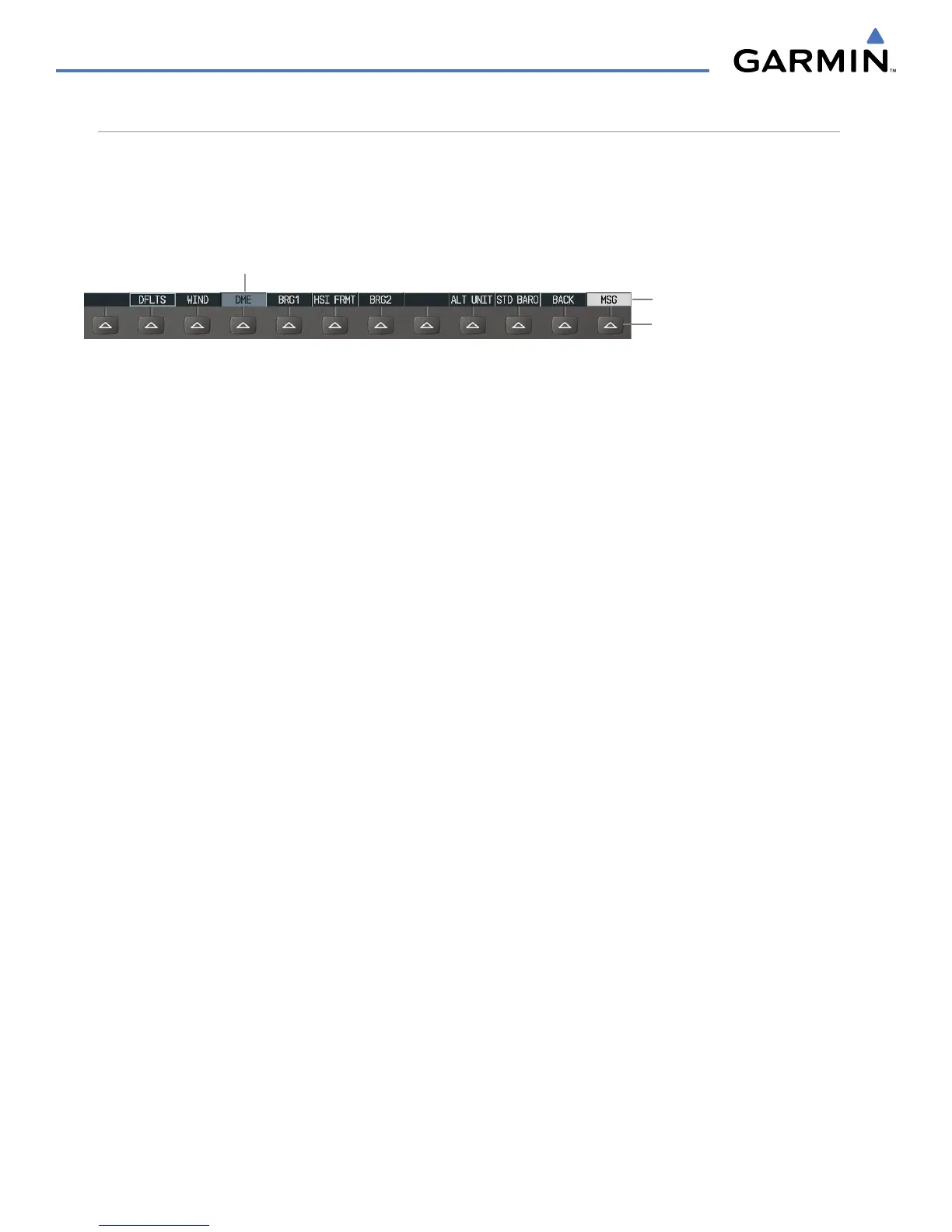
SOFTKEY FUNCTION
The softkeys are located along the bottoms of the displays. The softkeys shown depend on the softkey level
or page being displayed. The bezel keys below the softkeys can be used to select the appropriate softkey. When
a softkey is selected, its color changes to black text on gray background and remains this way until it is turned
off, at which time it reverts to white text on black background.
Softkey Names (displayed)
Figure 1-15 Softkeys (Second-Level PFD Configuration)
Bezel-Mounted Softkeys (press)
Softkey On
Another means of selecting softkeys is by using the MFD/PFD Control Unit:
To select a softkey using the MFD Control Unit:
1) Move the softkey selection box to the desired softkey using the arrows of the SEL Key.
2) Press the center of the SEL Key to select the desired softkey.
PFD SOFTKEYS
The
CDI
,
IDENT
,
TMR/REF
,
NRST,
and
MSG
Softkeys undergo a momentary change to black text on gray
background and automatically switch back to white text on black background when selected. If messages
remain after acknowledgement, the MSG Softkey is black on white.
The PFD softkeys provide control over flight management functions, including GPS, NAV, terrain, traffic,
and lightning (optional). Each softkey sublevel has a
BACK Softkey which can be pressed to return to the
previous level. The MSG Softkey is visible in all softkey levels. For the top level softkeys and the transponder
(XPDR) levels, the IDENT Softkey remains visible.
INSET
Displays Inset Map in PFD lower left corner
OFF
Removes Inset Map
DCLTR (3)
Selects desired amount of map detail; cycles through declutter
levels:
DCLTR (No Declutter): All map features visible
DCLTR-1: Declutters land data
DCLTR-2: Declutters land and SUA data
DCLTR-3: Removes everything except for the active flight
plan
TRAFFIC
Displays traffic information on Inset Map
TOPO
Displays topographical data (e.g., coastlines, terrain, rivers, lakes)
and elevation scale on Inset Map
TERRAIN
Displays terrain information on Inset Map
NEXRAD
Displays NEXRAD weather and coverage information on Inset
Map (optional feature)
XM LTNG
Displays XM lightning information on Inset Map (optional feature)

 Loading...