Garmin G1000 Pilot’s Guide for the Socata TBM 850
190-00709-00 Rev. A6-34
HAZARD AVOIDANCE
SAFE OPERATING DISTANCE
The following information establishes a minimum safe distance from the antenna for personnel near
operating weather radar. The minimum safe distance is based on the FCC’s exposure limit at 9.3 to 9.5 GHz for
general population/uncontrolled environments, which is 1 mW/cm2. See Advisory Circular 20-68B for more
information on safe distance determination.
MAXIMUM PERMISSIBLE EXPOSURE LEVEL (MPEL)
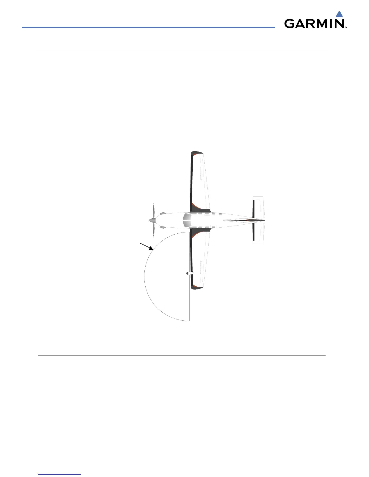
The zone in which the radiation level exceeds the US Government standard of 1 mW/cm2 is the semicircular
area of at least 9.16 feet from the 10-inch antenna. All personnel must remain outside of this zone. With a
scanning or rotating beam, the averaged power density at the MPEL boundary is significantly reduced.
MPEL
Boundar
y
9.16 ft. for 10”
antenna
Figure 6-40 MPEL Boundary
BASIC ANTENNA TILT SETUP
The following discussion is a simple method for setting up the weather radar antenna tilt for most situations.
It is not to be considered an all encompassing setup that works in all situations, but this method does provide
good overall parameters for the monitoring of threats. Ultimately, it is desired to have the antenna tilted so that
the bottom of the radar beam is four degrees below parallel with the ground. The following example explains
one way of achieving this.
With the aircraft flying level, adjust the antenna tilt so ground returns are displayed at a distance that equals
the aircraft’s current altitude (AGL) divided by 1,000. For example, if the aircraft is at 14,000 feet, adjust the
tilt so the front edge of ground returns are displayed at 14 nautical miles. Note this antenna tilt angle setting.
Now, raise the antenna tilt 6 degrees above this setting. The bottom of the radar beam is now angled down 4º
from parallel with the ground.

 Loading...