23GTN 650: VERTICAL NAVIGATION
a. TOUCH VS Target.
b. Use the keypad to enter a new VS target.
2. To change the FPA:
a. TOUCH Flight Path Angle.
b. Use the keypad to enter a new angle for your descent.
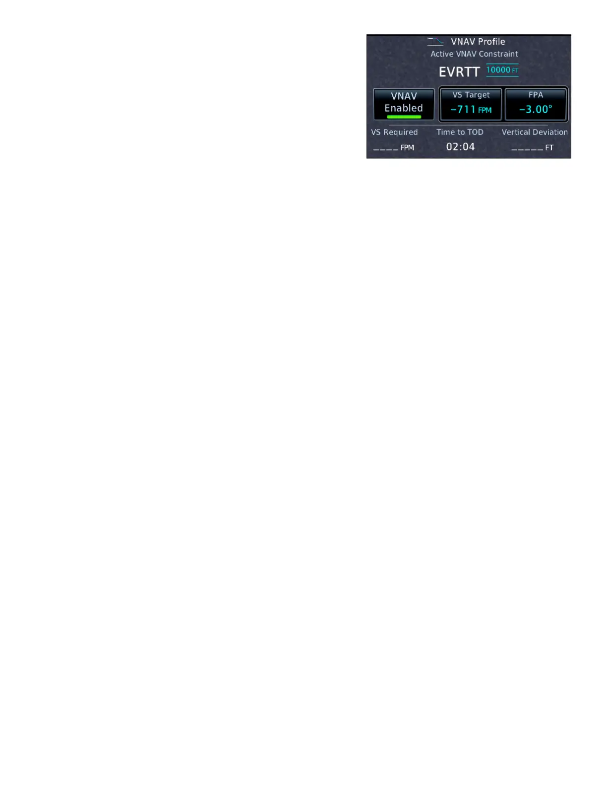
Whenever you change the VS target, the FPA will also
change, because descending less rapidly for a given groundspeed
requires descending less steeply. e same is true if you change
the ight path angle; the VS target will change. e VS Required,
Time to TOD (top of descent), and Vertical Deviation will also change accordingly.
Change the default Flight Path Angle
1. While the VNAV Prole window is in view, TOUCH Menu.
2. TOUCH Default FPA in the VNAV Prole Menu.
3. Use the keypad to enter a new FPA.
4. TOUCH Enter.
You can create a parallel track PTK in the active ight plan to y a course oset from each leg. However:
1. Parallel tracks are not available when ying an approach procedure.
2. VNAV guidance is not available when you are ying a parallel track.
Create a parallel track
1. On the Active Flight Plan page, TOUCH Menu.
2. TOUCH Parallel Track.
3. In the Parallel Track window, TOUCH Direction (to specify Le or Right of the default track) and then
TOUCH Oset (to specify the oset distance 1-99 NM).
4. Conrm the information you entered, and then TOUCH Activate.
5. On the Active Flight Plan page, “–P” appears next to the waypoints in the ight plan.
Cancel a parallel track
1. On the Active Flight Plan page, TOUCH Menu.
2. In the Active Flight Plan Menu page, TOUCH Remove PTK.
Use VNAV while flying approaches
e VNAV feature, described in “Using Vertical Navigation (VNAV) and Along-Track Osets” earlier in this
manual, is available with GTN system soware 6.5 and later. VNAV can help you manage descents.
Key points for using VNAV
• When you load an approach, the GTN retrieves published altitude constraints for legs along transitions
and feeder routes up to the FAF. ese altitudes appear on the Active Flight Plan page in the ALT col-
umn next to waypoint names.
• If you have a PFD (next page) connected to a GTN congured for VNAV, the VNAV cues help you meet
altitude constraints outside the FAF. For more information about the VNAV cues that appear on exter-
nal PFDs, see the guides for your PFD.
• VNAV is not available aer the FAF.
• If you are ying an approach with approved or advisory vertical guidance, the appropriate RNAV glide-
path or ILS glideslope vertical deviation indicator appears on your PFD or HSI as you intercept the
vertical path at or near the FAF.
 Loading...


