29GTN 650: OTHER FEATURES AND CUSTOMIZATION
near a waypoint location. VCALC is not available when ground-
speed is less than 35 knots or aer the FAF on an approach. When
VCALC is active, the GTN displays messages on the navigation
pages to alert you to begin a descent.
Use VCALC instead of VNAV
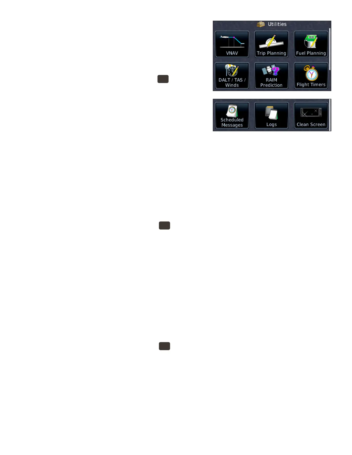
1. To display the Utilities page, PRESS the
HOME
button in the
upper-right corner of the bezel.
2. On the Home page, TOUCH Utilities.
3. On the Utilities page, TOUCH VCALC.
4. In the Utilities–VCALC window, TOUCH Target ALT to
specify an altitude, such as the trac pattern altitude at
the destination airport.
5. To specify an MSL or AGL (above WPT) altitude, TOUCH Altitude Type.
6. To set a preferred vertical speed, TOUCH VS Prole.
7. To specify an oset in nautical miles prior to or aer the target waypoint, TOUCH Oset.
8. To change the waypoint, TOUCH Target Waypoint.
9. To return to the default settings for VCALC, TOUCH Menu and TOUCH Restore.
10. To enable or cancel VCALC messages, TOUCH Menu and TOUCH Display Messages.
View trip planning information
e Trip Planning page provides information about the active ight plan or direct-to ight, such as the distance
remaining, ETE, and ETA.
1. To display the Utilities page, PRESS the
HOME
button in the upper-right corner of the bezel.
2. On the Home page, TOUCH Utilities.
3. On the Utilities page, TOUCH Trip Planning.
4. To view information about the current ight, TOUCH Mode to select either Flight Plan or Point to
Point. (To view data only from the present position to the destination, TOUCH P.POS.)
5. To view trip planning data to waypoints other than the departure airport or destination, TOUCH From
or To and use the keypad to enter a new waypoint name or names.
6. For more information, see “14.4 Trip Planning” in the GTN 625/635/650 Pilot’s Guide.
View fuel planning information
If your GTN is connected to external fuel ow and fuel quantity sensors, the GTN can display information
about the estimated fuel on board and the fuel required to reach the destination or a waypoint you specify. You
can also review estimated fuel required for another ight plan stored in the catalog, a specic leg in the active
ight, or from the present position to a waypoint you specify.
1. To display the Utilities page, PRESS the
HOME
button in the upper-right corner of the bezel.
2. On the Home page, TOUCH Utilities.
3. On the Utilities page, TOUCH Fuel Planning.
4. To use data from connected fuel sensors, TOUCH Use Sensor Data.
a. If your GTN is connected to both fuel quantity and fuel ow sensors, it displays the estimated cur-
rent fuel on board and fuel ow.
b. If your GTN is connected to only a fuel ow sensor, you must enter the estimated fuel on board.
c. If your GTN is not connected to fuel sensors, you must enter both the estimated fuel on board and
fuel ow.
For more information, see “14.6 Fuel Planning” in the GTN 625/635/650 Pilot’s Guide.
 Loading...


