Mimosa Backhaul Help Content
Mimosa Backhaul Location
Copyright © 2014 Mimosa Page 123
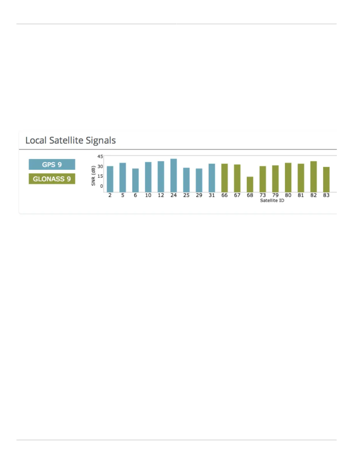
Interpreting Local Satellite Signals
Product Applicability: B5/B5c, B11
The Local Satellite Signals panel contains a chart showing both GPS and GLONASS satellites in blue and green,
respectively, from which the radio can obtain position and timing data used for synchronization. Each numbered
column represents a unique satellite with the columns’ amplitude representing the signal to noise ratio of the
satellite’s signal at the radio’s receiver. The number of satellites the radio detects and the SNR of each both
contribute to clock accuracy.
 Loading...