119
Map
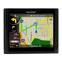
Nextar Navigation System works with digital maps which are not
simply the computerised versions of traditional paper maps. Similarly
to the paper road maps, the 2D mode of digital maps show you streets,
roads, and elevation is also shown by colors.
You can use digital maps interactively: you can zoom in and out
(increase or decrease the scale), you can tilt them up and down, and
turn them left and right. In GPS-supported navigation, digital maps
facilitate route planning.
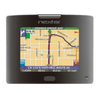
North-up map orientation
In North-up mode the map is rotated so its top always faces North.
This is the orientation in 2D map view mode and in Overview mode.
See also: Track-up map orientation.
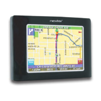
Overview mode
You can instruct Nextar Navigation System to automatically switch to
Overview mode if the next route event is in a distance. In Overview
mode the map is shown in 2D but scaled down to a predefined zoom
level. When you approach the next route event, the previous 2D or 3D
map view returns automatically.
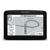
Route
A series of destinations to be reached one after the other. A simple
route contains one start point and only one destination. Multi-point
routes contain one or more via points (intermediate destinations). The
last route point is the final destination and the route is cut into different
legs (from one destination to the next).
 Loading...