31NX501E/NZ501E
English
English
Owner’s Manual
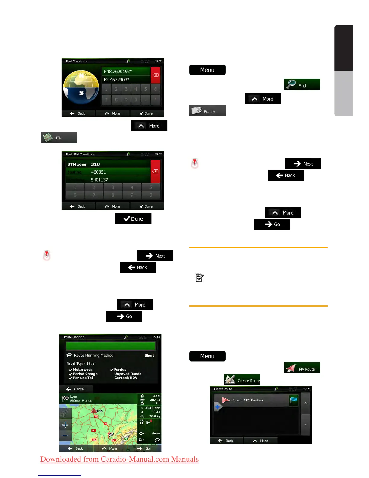
4. You can enter the latitude and longitude
values in any of the following formats: decimal degrees;
degrees and decimal minutes; or degrees, minutes and
decimal seconds.
5. (optional) If necessary, tap then
and enter the coordinate in UTM format.
6. When finished, tap .
7. A full screen map appears with the selected
point in the middle. If necessary, tap the map
somewhere else to modify the destination. The Cursor (
) appears at the new location. Tap to
confirm the destination, or tap to select
a different destination.
8. After a short summary of the route parameters,
the map appears showing the entire route. The route is
automatically calculated. Tap
to modify
route parameters, or tap and start your
journey.
3.1.8 Navigate to a location stored in a photo
You can also set the location stored in a photo as your
destination. Do as follows:
1. If you are on the Map screen, tap
to return to the Navigation menu.
2. In the Navigation menu, tap .
3. Open the menu and tap
.
4. The list of photos stored in the device appears.
Select one photo from the list.
5. A full screen map appears with the selected
point in the middle. If necessary, tap the map
somewhere else to modify the destination. The Cursor (
) appears at the new location. Tap to
confirm the destination, or tap to select
a different destination.
6. After a short summary of the route parameters,
the map appears showing the entire route. The route is
automatically calculated. Tap
to modify
route parameters, or tap and start your
journey.
Note!
Only geotagged JPG files contain location
information. That is why these kind of files
can only be used in navigation. Other
picture files do not appear in the list.
Files must be located on an inserted SD
card or USB pendrive, either in the root
folder or in a "pictures" folder.
3.1.9 Building a route from the list of
destinations (Create Route)
You can also build your route destination by destination
from the My Route menu.
1. If you are on the Map screen, tap
to return to the Navigation menu.
2. In the Navigation menu, tap .
3. Tap .
Clarion_primo_1_1_EU_UserManual_EN-UK.indd 31 2011-2-23 11:24:02
Downloaded from Caradio-Manual.com Manuals

 Loading...