36 NX501E/NZ501E
English
Owner’s Manual
2. Tap and then tap one of the
following:
•
•
•
•
3. Clarion Mobile Map recalculates the route
optimised for the new vehicle type. The orange line now
shows the new recommended route.
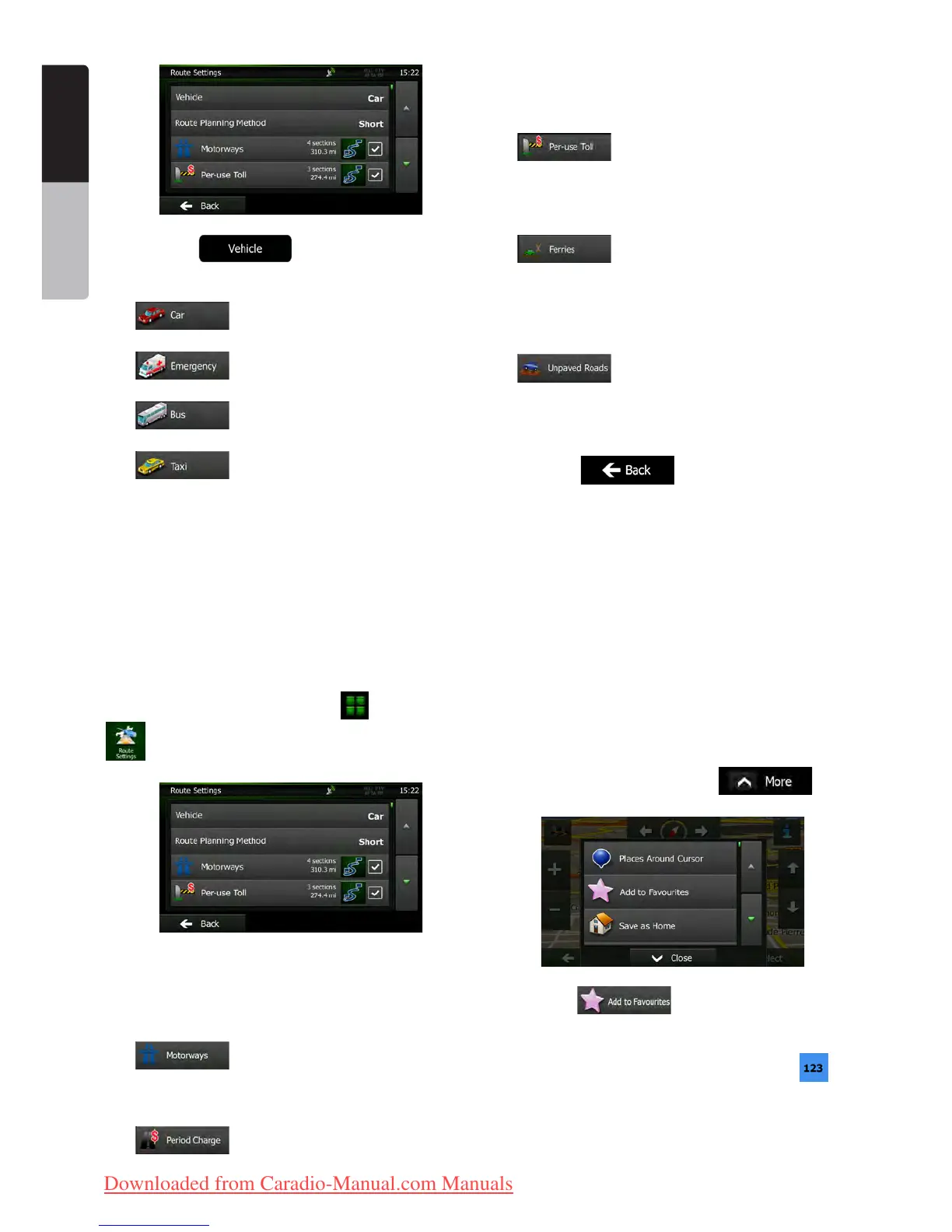
3.4.9 Changing the road types used in route
planning
To recalculate the active route with different road type
preferences, do as follows. These changes can also be
made in Settings (page 45).
1. On the Map screen, tap and then tap
.
2. Tap any of the listed road types to modify the
route. If needed, scroll the list for all road types. You
have the following options (their order depends on the
selected vehicle type):
• - You might need to avoid
motorways when you are driving a slow car or you
are towing another vehicle.
• - Charge roads are pay roads where
you can purchase a pass or vignette to use the road
for a longer period of time. They can be enabled or
disabled separately from toll roads.
• - Clarion Mobile Map includes toll
roads (pay roads where there is a per-use charge)
in the routes by default. If you disable toll roads,
Clarion Mobile Map plans the best toll-free route.
• - Clarion Mobile Map includes
ferries in a planned route by default. However, a
map does not necessarily contain information
about the accessibility of temporary ferries. You
might also need to pay a fare on ferries.
• - Clarion Mobile Map excludes
unpaved roads by default: unpaved roads can be
in a bad condition and usually you cannot reach the
speed limit on them.
3. Tap to confirm the changes.
Clarion Mobile Map recalculates the route. The orange
line now shows the new recommended route.
3.5 Saving a location as a Favourite
destination
You can add any location to Favourites, the list of
frequently used destinations. Planning a route to one
of the Favourite destinations is described on page 29.
1. Select a destination as described before. It
can be an address, a Place, any location on the map,
a previously used destination from History, a coordinate
or a location where a photo was taken.
2. When the full screen map appears with the
selected location in the middle, tap
.
3. Tap .
4. (optional) Using the keyboard, you can
change the name offered for the Favourite. Tap
to
enter numbers or symbols.
Clarion_primo_1_1_EU_UserManual_EN-UK.indd 36 2011-2-23 11:24:11
Downloaded from Caradio-Manual.com Manuals

 Loading...