TOPO SHOT FOR TOPOGRAPHIC SURVEY
PERFORM T
OPOGRAPHIC SURVEYS
You can continuously measure and record the coordinates of the blade edge position at a fixed interval or at any
time.
TAKE A TOPO SHOT OF BLADE ELEVATION FOR TOPOGRAPHIC SURVEY IN
CERTAIN INTERVAL
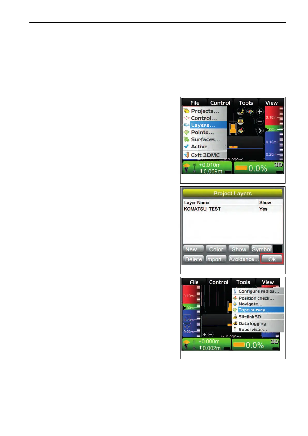
1.
On the main window, press “iB logo key” and display the
main menu.
2.
On “File” menu, press “Layers...” and select.
3.
On “Project Layers” screen, make a new layer for record-
ing topographic survey
.
4.
Press “Ok”.
5.
On the main window, press “iB logo key” and display the
main menu.
6.
On “Tools” menu, press “Topo survey...” and select.
HANDLE CONTROL BOX TOOLS MENU
4-47
 Loading...