STATUS GPS1200 177
24 STATUS
24.1 STATUS: Survey...
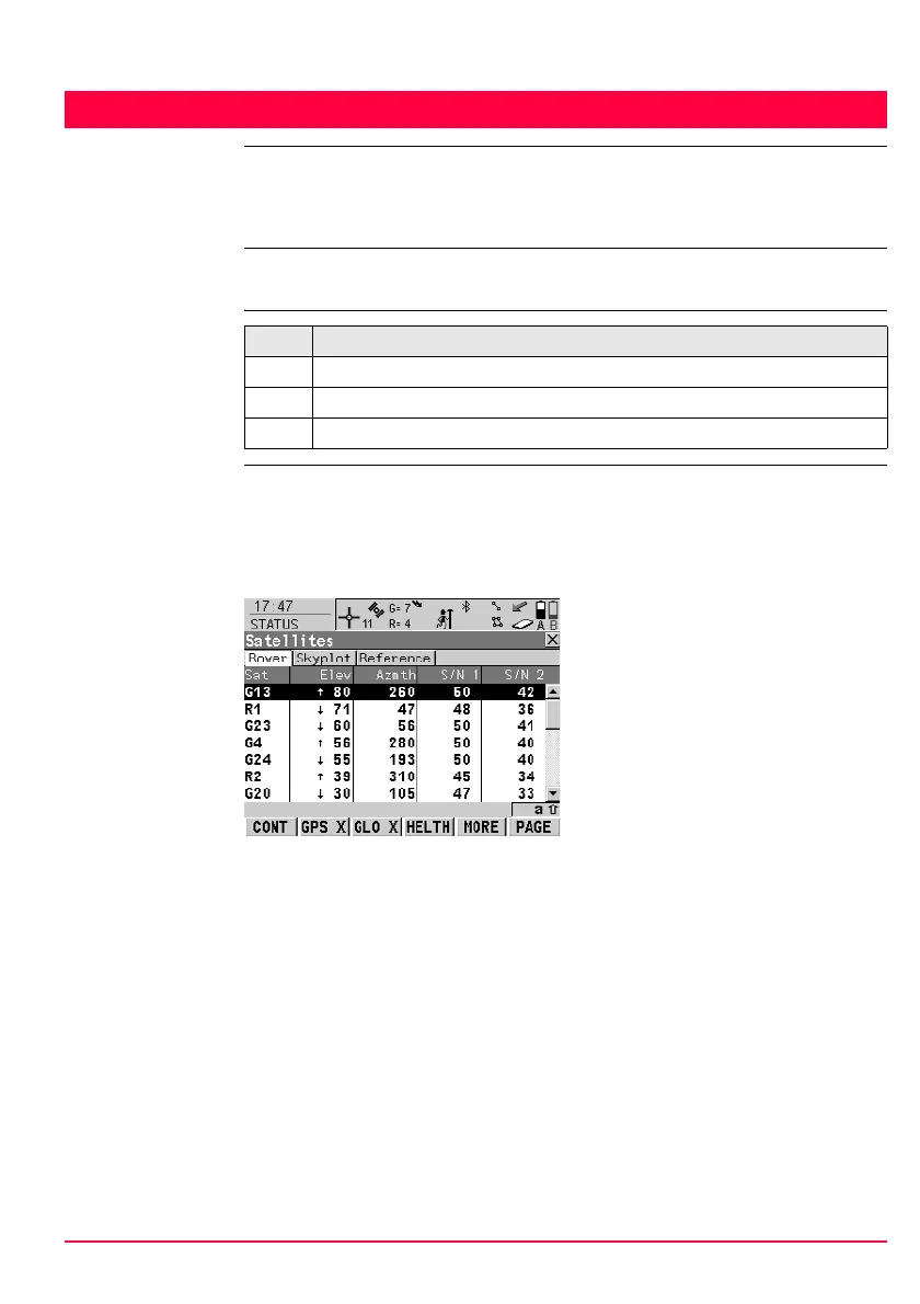
24.1.1 Satellite Status
Description This screen shows information related to the satellites ordered by the elevation
angle.
Access
STATUS
Satellites,
Satellites page;
STATUS
Satellites,
Rover page
The name of the page changes depending on the active receiver configuration.
The information about the satellites at the reference shown on the Reference page
is identical with the information shown on STATUS Satellites, Rover page
Step Description
1. Press USER to access GPS1200 User Menu.
2. Press STAT (F3) to access STATUS Status Menu.
3. Select Survey...\Satellite Status.
CONT (F1)
To exit STATUS Satellites.
GPS X / GPS 9 (F2)
To hide or show the GPS satellites
(shown by the prefix G). Available for
GX1230 GG/ATX1230 GG when
<Sat System: GPS & Glonass> is
configured in CONFIGURE Satellite
Settings.
GLO X / GLO 9 (F3)
To hide or show the GLONASS satel-
lites (shown by the prefix R).
Available for GX1230 GG/
ATX1230 GG when <Sat System:
GPS & Glonass> is configured in
CONFIGURE Satellite Settings.
HELTH (F4)
To view the numbers of satellites
categorised in good, bad and unavail-
able.
MORE (F5)
To open and close a window showing
the date of the used almanac, the
number of satellites tracked as
shown on the skyplot and the number
of all satellites available above the
cut off elevation mask as shown on
the skyplot.

 Loading...